MyTopo
Graysville Missouri US Topo Map
Couldn't load pickup availability
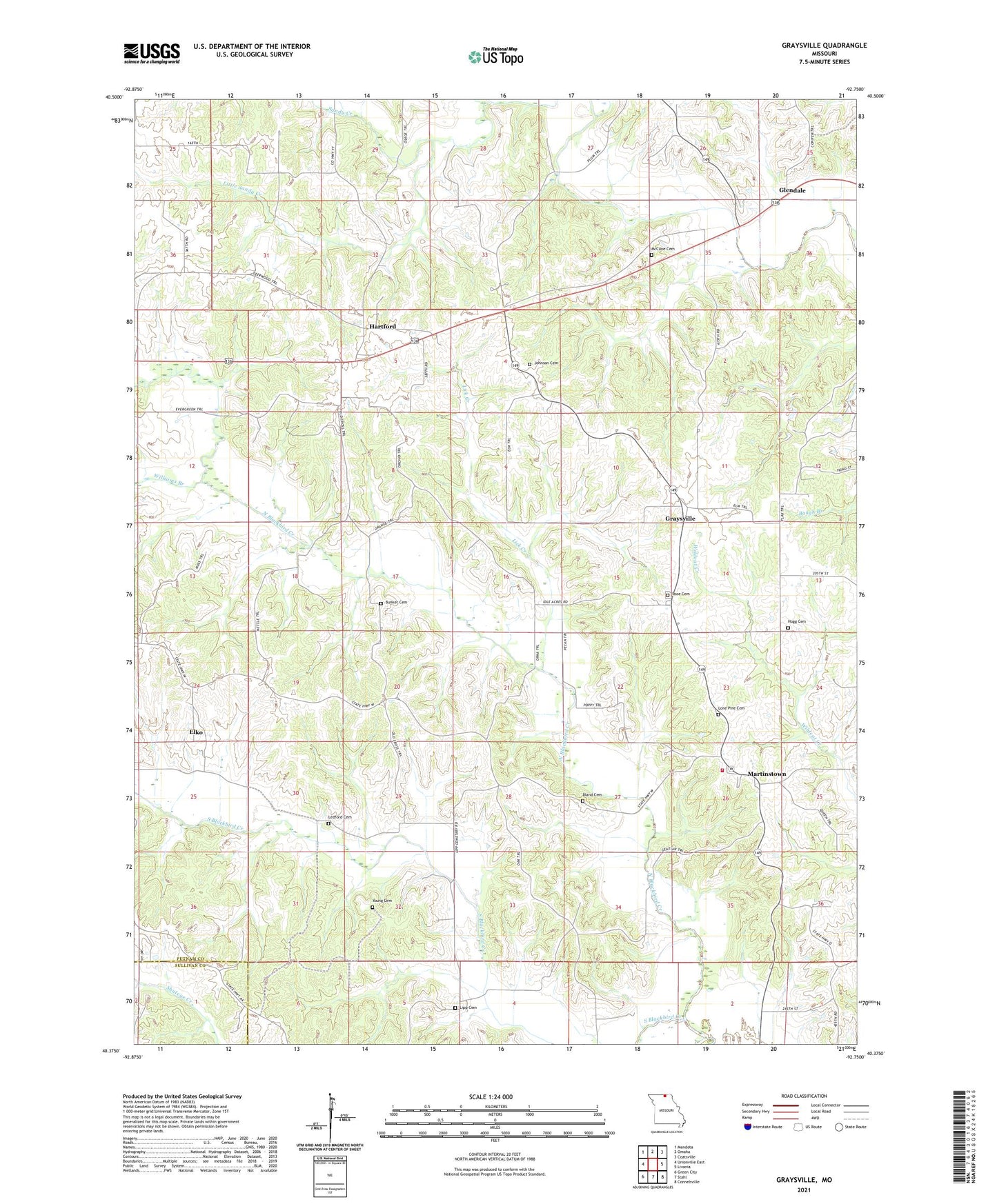
2021 topographic map quadrangle Graysville in the state of Missouri. Scale: 1:24000. Based on the newly updated USGS 7.5' US Topo map series, this map is in the following counties: Putnam, Sullivan. The map contains contour data, water features, and other items you are used to seeing on USGS maps, but also has updated roads and other features. This is the next generation of topographic maps. Printed on high-quality waterproof paper with UV fade-resistant inks.
Quads adjacent to this one:
West: Unionville East
Northwest: Mendota
North: Omaha
Northeast: Coatsville
East: Livonia
Southeast: Connelsville
South: Stahl
Southwest: Green City
Contains the following named places: Bland Cemetery, Bradshaw School, Bunker Cemetery, Burns School, Elko, Elm Township Fire Protection District, Faith Tabernacle, Fowler School, Glendale, Graysville, Graysville School, Hartford, Hartford School, Haynes School, Hogg Cemetery, Johnson Cemetery, Ledford Cemetery, Ledford School, Lick Creek, Lipp Cemetery, Little Sandy Creek, Lone Pine Cemetery, Martinstown, McCune Cemetery, North Blackbird Creek, Pickering School, Rehobeth Church, Rose Cemetery, Sandy Creek, South Blackbird Creek, Township of Elm, Williams Branch, Young Cemetery