MyTopo
Green Ridge North Missouri US Topo Map
Couldn't load pickup availability
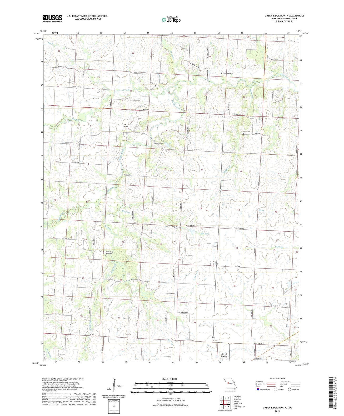
2021 topographic map quadrangle Green Ridge North in the state of Missouri. Scale: 1:24000. Based on the newly updated USGS 7.5' US Topo map series, this map is in the following counties: Pettis. The map contains contour data, water features, and other items you are used to seeing on USGS maps, but also has updated roads and other features. This is the next generation of topographic maps. Printed on high-quality waterproof paper with UV fade-resistant inks.
Quads adjacent to this one:
West: Burtville
Northwest: Knob Noster
North: La Monte
Northeast: Hughesville
East: Sedalia West
Southeast: Ionia
South: Green Ridge South
Southwest: Windsor
Contains the following named places: Allen School, Bee Branch, Bethel School, Botts Cemetery, Brushy Creek, Craighead Cemetery, Crystal Springs School, East Elk Fork, Elk Fork, Elm Fork, Hickory Point Church, Hickory Point School, Hughes Lake Dam, Jackson School, Lone Elm School, Long Branch, Old Bethel Cemetery, Old Hickory Point Cemetery, Pleasant Green School, Prairie View Church, Prairie View School, Rabourn Cemetery, Township of Elk Fork, Walnut Branch, West Elk Fork, Weston Lake Dam