MyTopo
Ionia Missouri US Topo Map
Couldn't load pickup availability
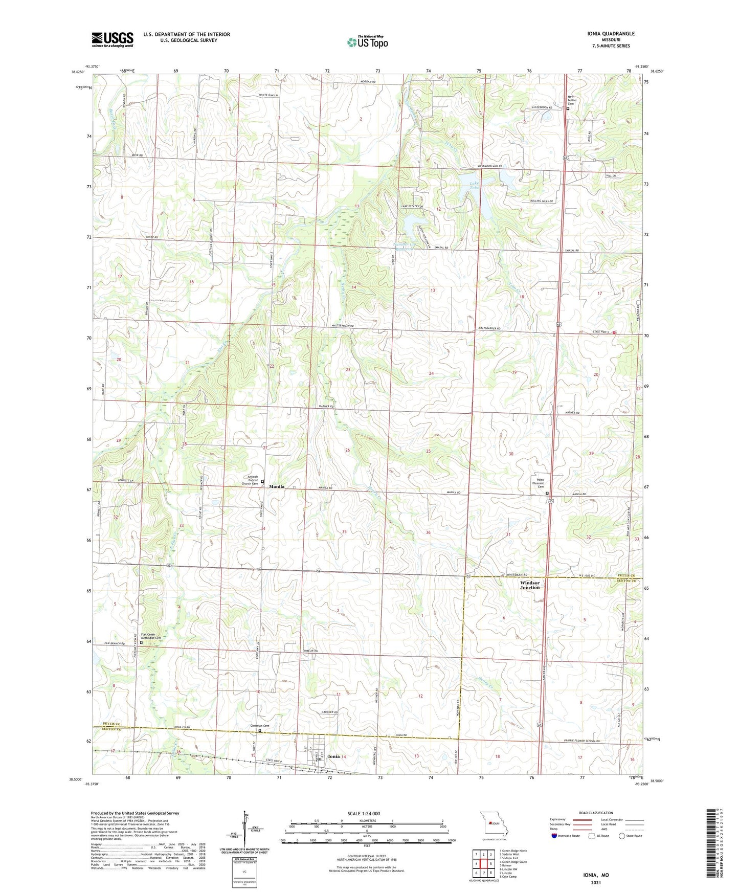
2021 topographic map quadrangle Ionia in the state of Missouri. Scale: 1:24000. Based on the newly updated USGS 7.5' US Topo map series, this map is in the following counties: Pettis, Benton. The map contains contour data, water features, and other items you are used to seeing on USGS maps, but also has updated roads and other features. This is the next generation of topographic maps. Printed on high-quality waterproof paper with UV fade-resistant inks.
Quads adjacent to this one:
West: Green Ridge South
Northwest: Green Ridge North
North: Sedalia West
Northeast: Sedalia East
East: Bahner
Southeast: Cole Camp
South: Lincoln
Southwest: Lincoln NW
This map covers the same area as the classic USGS quad with code o38093e3.
Contains the following named places: Center View School, Christian Cemetery, Cottage School, Flat Creek Methodist Cemetery, Henry Creek, Ionia, Ionia Post Office, Knight Lake Dam, Lake Tebo, Manila, New Bethel Cemetery, New Bethel United Methodist Church, Number 130 Reservoir, Pettis County Fire District 1 Station 5, Pleasant View School, Point Pleasant Cemetery, Prairie Flower School, South Flat Creek, South Side School, Tebo Creek, Tebo Lake Dam, Town of Ionia, Township of Washington, Wesner Lake Dam, Windsor Junction, ZIP Code: 65335