MyTopo
Green Ridge South Missouri US Topo Map
Couldn't load pickup availability
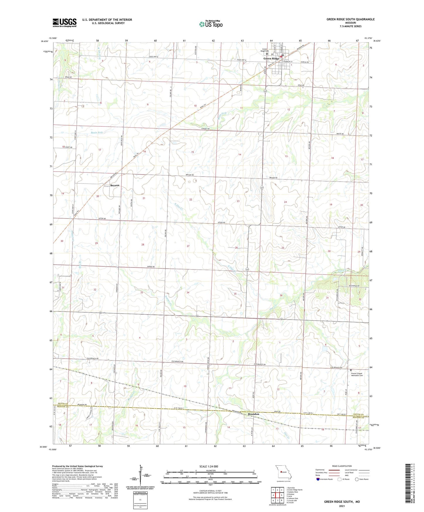
2021 topographic map quadrangle Green Ridge South in the state of Missouri. Scale: 1:24000. Based on the newly updated USGS 7.5' US Topo map series, this map is in the following counties: Pettis, Benton. The map contains contour data, water features, and other items you are used to seeing on USGS maps, but also has updated roads and other features. This is the next generation of topographic maps. Printed on high-quality waterproof paper with UV fade-resistant inks.
Quads adjacent to this one:
West: Windsor
Northwest: Burtville
North: Green Ridge North
Northeast: Sedalia West
East: Ionia
Southeast: Lincoln
South: Lincoln NW
Southwest: Calhoun East
This map covers the same area as the classic USGS quad with code o38093e4.
Contains the following named places: Bennett School, Brandon, Bryson, City of Green Ridge, Elm Branch School, Green Ridge, Green Ridge Community Fire Department, Green Ridge Elementary School, Green Ridge High School, Green Ridge Post Office, Hope Dale School, Maple Grove School, North Flat Creek, Pepper Creek, Pleasant Hill School Number One, Prairie Chapel Methodist Cemetery, Steve Smith Lake Dam, Swisher School, Township of Green Ridge, ZIP Code: 65332