MyTopo
Greentop Missouri US Topo Map
Couldn't load pickup availability
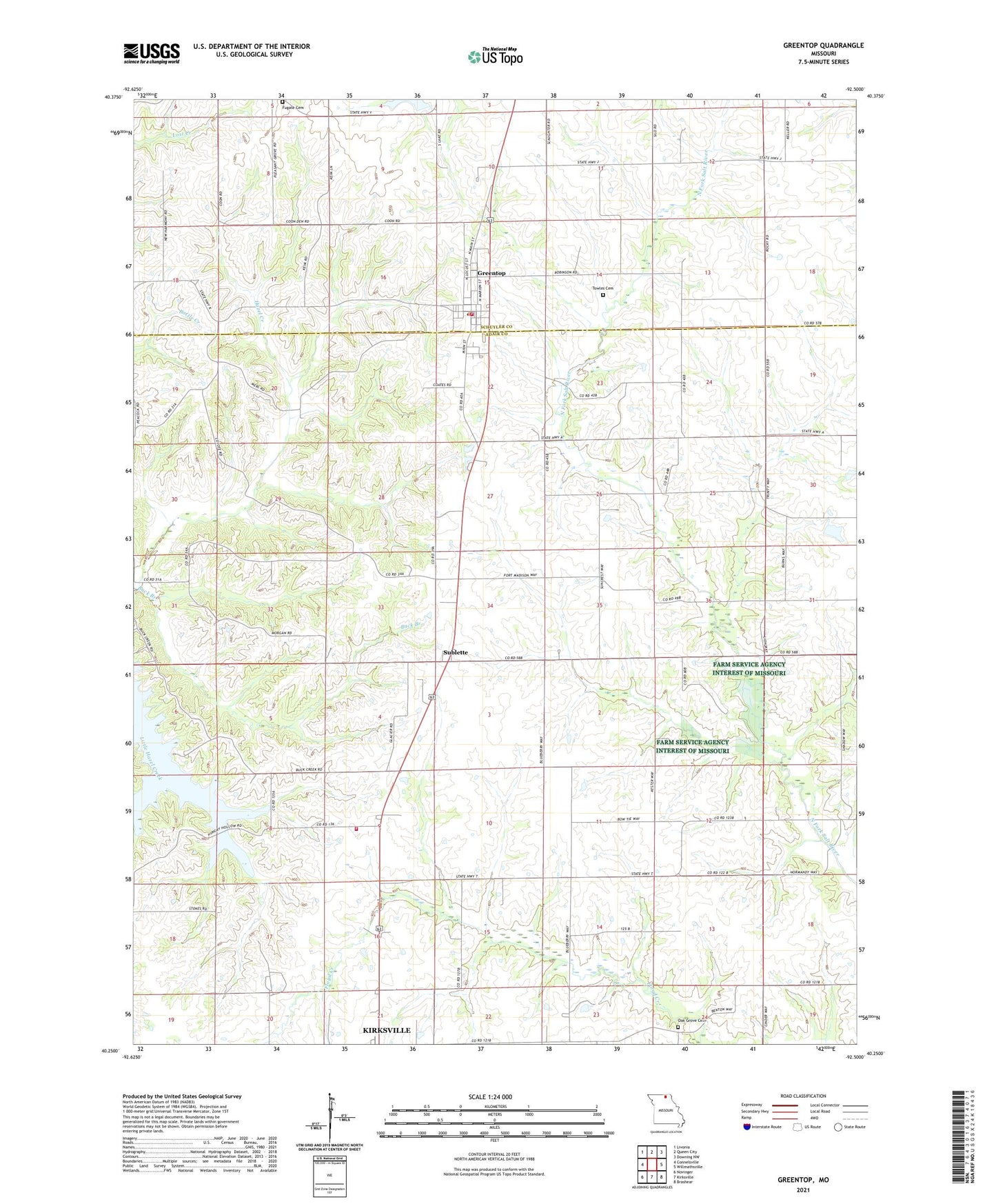
2021 topographic map quadrangle Greentop in the state of Missouri. Scale: 1:24000. Based on the newly updated USGS 7.5' US Topo map series, this map is in the following counties: Adair, Schuyler. The map contains contour data, water features, and other items you are used to seeing on USGS maps, but also has updated roads and other features. This is the next generation of topographic maps. Printed on high-quality waterproof paper with UV fade-resistant inks.
Quads adjacent to this one:
West: Connelsville
Northwest: Livonia
North: Queen City
Northeast: Downing NW
East: Willmathsville
Southeast: Brashear
South: Kirksville
Southwest: Novinger
Contains the following named places: Browns School, Bryant School, Buck Branch, City of Greentop, Fort Madison Church, Fugate Cemetery, Fugate School, Gates School, Greentop, Greentop Fire Protection Association Station 1, Greentop Post Office, Gregory Lake Dam, Hazel Creek Church, Horn Lake, Horn Lake Dam, Kirksville Air Force Station, Maple Grove School, McKim School, New Harmony Church, Oak Grove Cemetery, Oak Grove School, Pleasant Hill School, Queen City Reservoir Dam, Refuge Community Church, Robert Horn Dam, Southwestern Adair County Rural Fire District, Sublette, Towles Cemetery, Township of Polk, Township of Salt River, Wells School, ZIP Code: 63546