MyTopo
Halltown NE Missouri US Topo Map
Couldn't load pickup availability
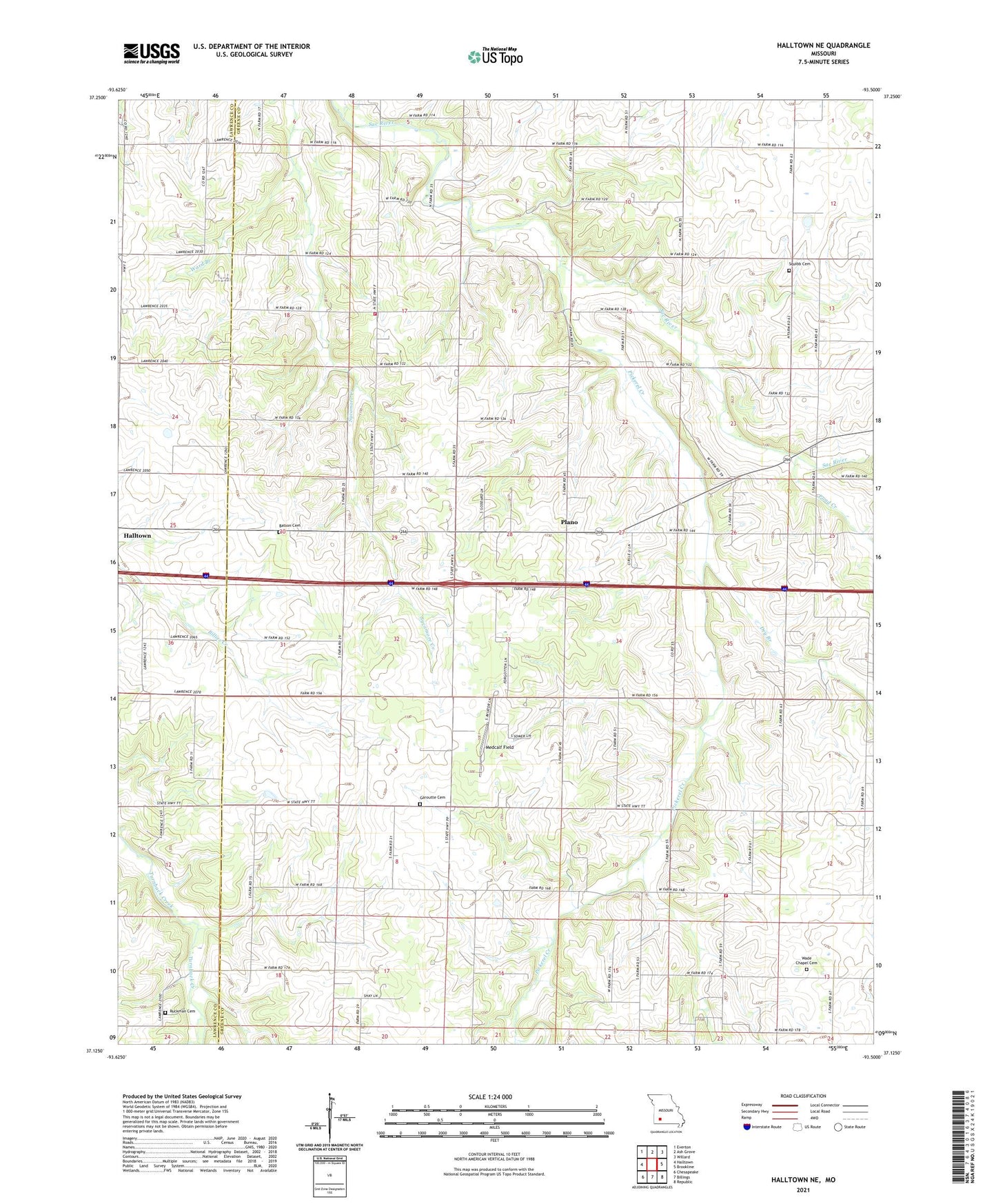
2021 topographic map quadrangle Halltown NE in the state of Missouri. Scale: 1:24000. Based on the newly updated USGS 7.5' US Topo map series, this map is in the following counties: Greene, Lawrence. The map contains contour data, water features, and other items you are used to seeing on USGS maps, but also has updated roads and other features. This is the next generation of topographic maps. Printed on high-quality waterproof paper with UV fade-resistant inks.
Quads adjacent to this one:
West: Halltown
Northwest: Everton
North: Ash Grove
Northeast: Willard
East: Brookline
Southeast: Republic
South: Billings
Southwest: Chesapeake
Contains the following named places: Batson Cemetery, Bois D Arc Fire Protection District Station 2, Carter School, Dry Branch, Garoutte Cemetery, Grand Junction School, Hopewell Church, Medcalf Field, Methodist Conference Grounds, Pickerel Creek, Plano, Pleasant View Church, Pond Creek, Prairie View School, Prospect Church, Ruckman Cemetery, Saint Elmo School, Salem School, Squibb Cemetery, Squibb School, Sycamore School, Township of Center Number 2, Township of Center Number 3, Township of Pond Creek, Wade Chapel, Wade Chapel Cemetery, Ward Branch, West Republic Fire Protection District, Yeakley, Yeakley Chapel, ZIP Codes: 65612, 65664, 65738