MyTopo
Chesapeake Missouri US Topo Map
Couldn't load pickup availability
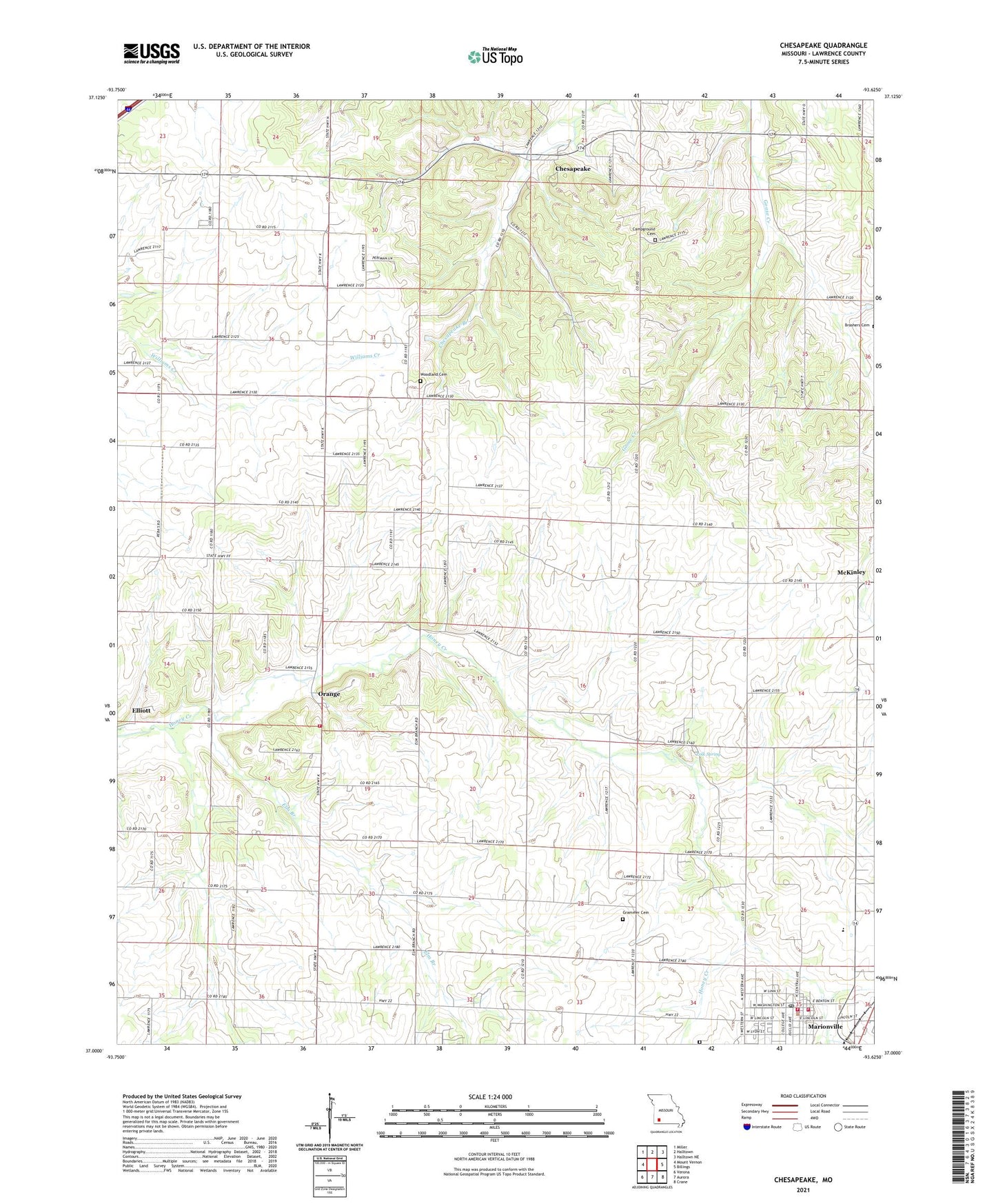
2021 topographic map quadrangle Chesapeake in the state of Missouri. Scale: 1:24000. Based on the newly updated USGS 7.5' US Topo map series, this map is in the following counties: Lawrence. The map contains contour data, water features, and other items you are used to seeing on USGS maps, but also has updated roads and other features. This is the next generation of topographic maps. Printed on high-quality waterproof paper with UV fade-resistant inks.
Quads adjacent to this one:
West: Mount Vernon
Northwest: Miller
North: Halltown
Northeast: Halltown NE
East: Billings
Southeast: Crane
South: Aurora
Southwest: Verona
This map covers the same area as the classic USGS quad with code o37093a6.
Contains the following named places: Aurora Country Club, Aurora Rural Fire Department Station 3, Buck Prairie School, Butler Cemetery, Campground Cemetery, Chesapeake, Chesapeake Census Designated Place, Chesapeake School, City of Marionville, Dover Church, Elliott, Elm Branch, Elm Branch Church, Elm Branch School, Fairview School, Grammer Cemetery, Honey Creek School, Lick Prairie Community Hall, Marionville, Marionville City Fire and Rescue, Marionville High School, Marionville Police Department, Marionville Post Office, Marionville Rural Fire Department, McKinley, McKinley School, McNeil Chapel, Mount Olive Church, Oakland School, Orange, Orange Church, Pleasant Valley School, Polk Spring, Prairie View School, Take-In School, Township of Turnback, Woodland Cemetery