MyTopo
Everton Missouri US Topo Map
Couldn't load pickup availability
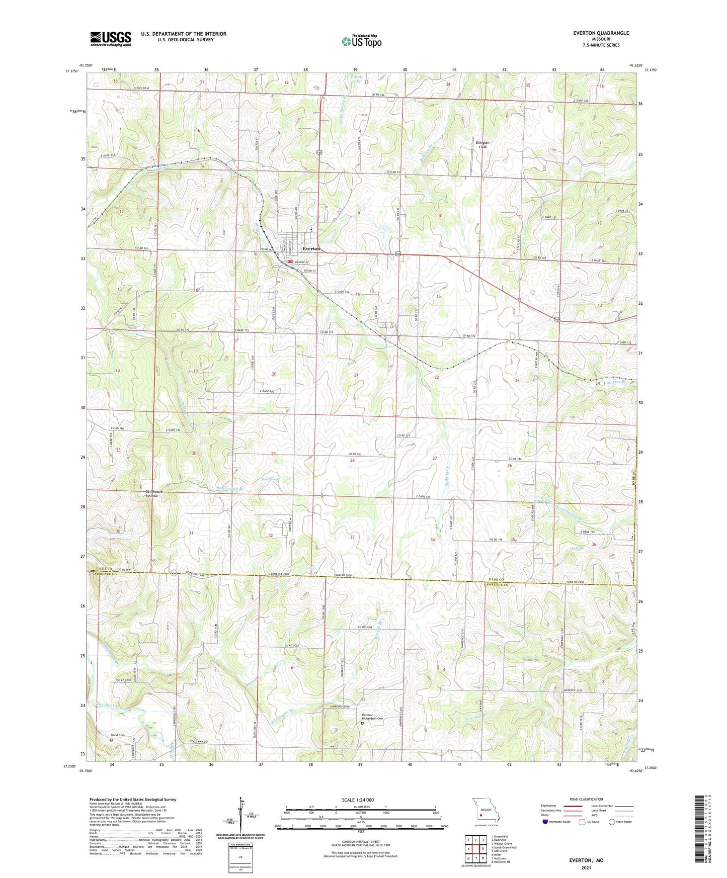
2021 topographic map quadrangle Everton in the state of Missouri. Scale: 1:24000. Based on the newly updated USGS 7.5' US Topo map series, this map is in the following counties: Dade, Lawrence, Greene. The map contains contour data, water features, and other items you are used to seeing on USGS maps, but also has updated roads and other features. This is the next generation of topographic maps. Printed on high-quality waterproof paper with UV fade-resistant inks.
Quads adjacent to this one:
West: South Greenfield
Northwest: Greenfield
North: Dadeville
Northeast: Walnut Grove
East: Ash Grove
Southeast: Halltown NE
South: Halltown
Southwest: Miller
This map covers the same area as the classic USGS quad with code o37093c6.
Contains the following named places: City of Everton, East Limekiln, Ellingsen Field, Emmett, Everton, Everton City Fire Department, Everton Elementary School, Everton High School, Everton Middle School, Everton Post Office, Everton Rural Fire Department, Grove School, Henry School, Hood Cemetery, Hopewell Church, Hopewell School, Independence School, Johnson Lake, KXBR-FM (Greenfield), Liberty Church, Mill Branch, Morrison - Richardson Cemetery, New Home Church, Ray Spring, Ray Spring Branch, Ray Spring Church, Ray Springs School, Scott School, Scott Spring, Scott Spring Branch, Silver Star School, Sinking Creek Church, Smyrna School, Township of Rock Prairie, Wright Branch, ZIP Code: 65646