MyTopo
Highlandville Missouri US Topo Map
Couldn't load pickup availability
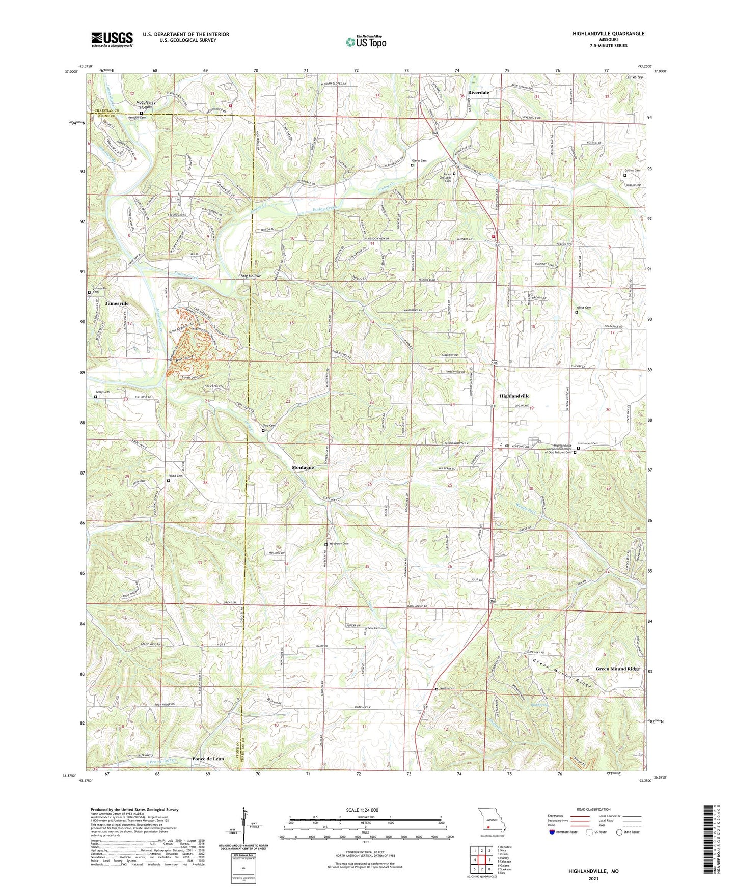
2021 topographic map quadrangle Highlandville in the state of Missouri. Scale: 1:24000. Based on the newly updated USGS 7.5' US Topo map series, this map is in the following counties: Christian, Stone. The map contains contour data, water features, and other items you are used to seeing on USGS maps, but also has updated roads and other features. This is the next generation of topographic maps. Printed on high-quality waterproof paper with UV fade-resistant inks.
Quads adjacent to this one:
West: Hurley
Northwest: Republic
North: Nixa
Northeast: Ozark
East: Selmore
Southeast: Day
South: Spokane
Southwest: Galena
Contains the following named places: Bengal, Bud Spring, City of Highlandville, Collins Cemetery, Craig Hollow, Eastern Star School, Finley Creek, Flood Cemetery, Flood School, Glenn Cemetery, Green Mound Ridge, Hidden Valley Golf Links, Highlandville, Highlandville Fire Protection District Station 3, Highlandville Independent Order of Odd Fellows Cemetery, Highlandville Post Office, Highlandville Rural Fire Protection District Station 1, Highlandville School, Hog Creek, Jamesville, Jamesville School, Jones Chastain Cemetery, Lebow Cemetery, Line School, Martin Cemetery, Mayberry Cemetery, McCafferty Hollow, Montague, Nixa Fire Protection District Station 4, Pleasant View Church, Ponce de Leon, Riverdale, Riverdale Church, Tory Cemetery, Tory Creek, Tory Creek School, Township of North Galloway, Township of Ponce de Leon, White Cemetery, Wolfden Branch, ZIP Code: 65669