MyTopo
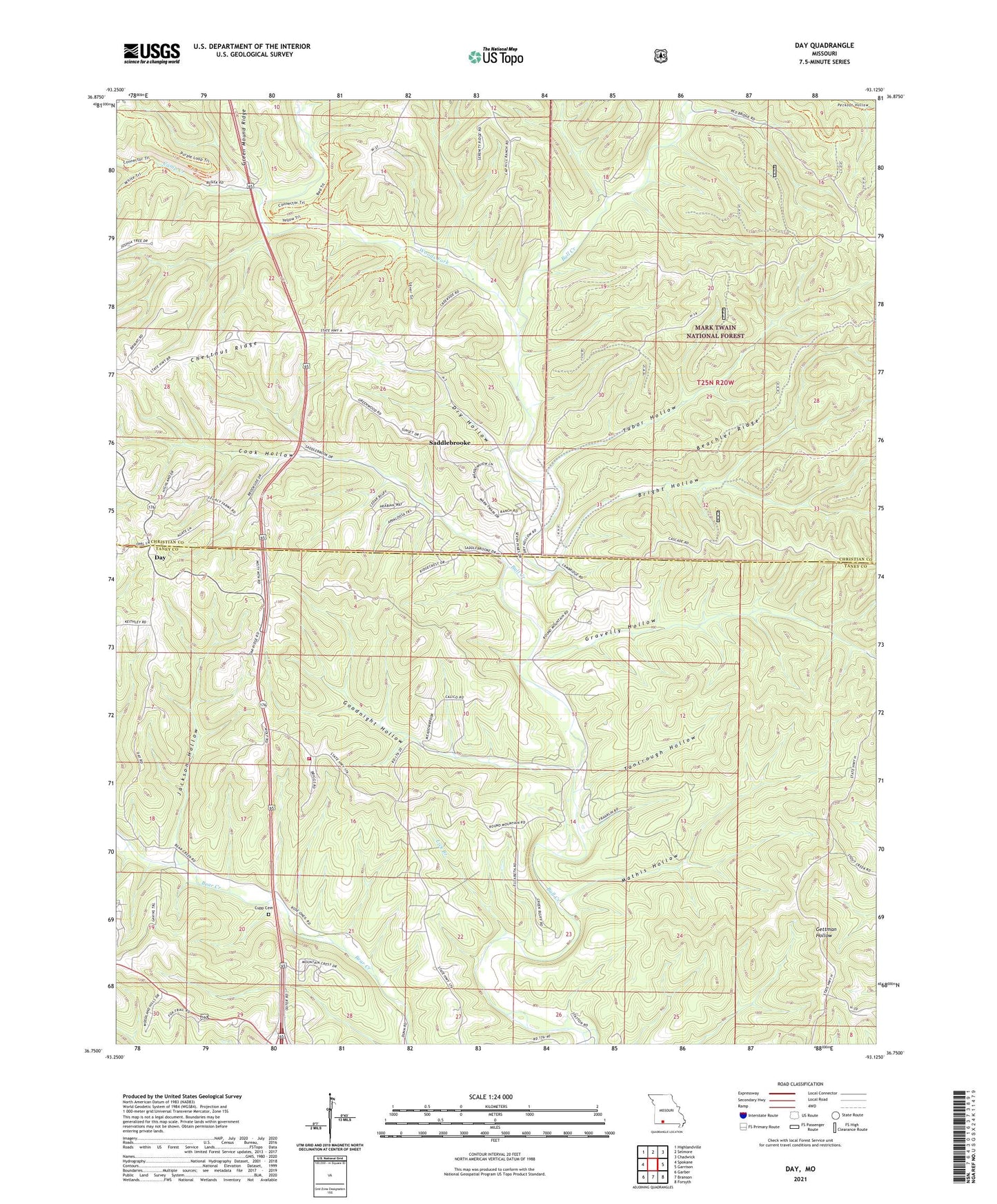
Day Missouri US Topo Map
Couldn't load pickup availability
Also explore the Day Forest Service Topo of this same quad for updated USFS data
2021 topographic map quadrangle Day in the state of Missouri. Scale: 1:24000. Based on the newly updated USGS 7.5' US Topo map series, this map is in the following counties: Taney, Christian. The map contains contour data, water features, and other items you are used to seeing on USGS maps, but also has updated roads and other features. This is the next generation of topographic maps. Printed on high-quality waterproof paper with UV fade-resistant inks.
Quads adjacent to this one:
West: Spokane
Northwest: Highlandville
North: Selmore
Northeast: Chadwick
East: Garrison
Southeast: Forsyth
South: Branson
Southwest: Garber
This map covers the same area as the classic USGS quad with code o36093g2.
Contains the following named places: Beachler Ridge, Bluff, Bright Hollow, Camp Creek, Cook Hollow, Cupp Cemetery, Day, Dry Hollow, Eaudevie, Eaudevie Post Office, Enterprise School, Goodnight Hollow, Gravelly Hollow, Highlandville Fire Protection District Station 4, Hill Top Lookout Tower, Hilltop School, Jackson Hollow, Lick Branch, Mathis Hollow, Meadows Church, Meadows School, New Haven Church, Oak Ridge Church, Pleasant Shade Church, Pleasant Shade School, Rainbows End Camp, Saddlebrooke, Tabor Hollow, Tantrough Hollow, Township of Jasper, Village of Saddlebrooke, Western Taney County Fire Protection District Station 9, Woods Fork, ZIP Codes: 65630, 65653, 65771