MyTopo
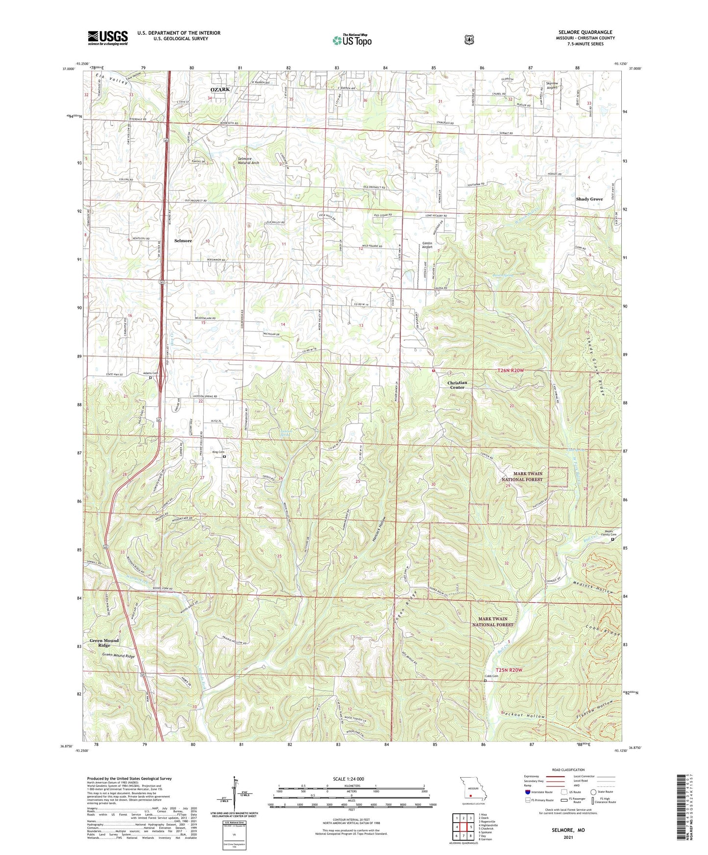
Selmore Missouri US Topo Map
Couldn't load pickup availability
Also explore the Selmore Forest Service Topo of this same quad for updated USFS data
2021 topographic map quadrangle Selmore in the state of Missouri. Scale: 1:24000. Based on the newly updated USGS 7.5' US Topo map series, this map is in the following counties: Christian. The map contains contour data, water features, and other items you are used to seeing on USGS maps, but also has updated roads and other features. This is the next generation of topographic maps. Printed on high-quality waterproof paper with UV fade-resistant inks.
Quads adjacent to this one:
West: Highlandville
Northwest: Nixa
North: Ozark
Northeast: Rogersville
East: Chadwick
Southeast: Garrison
South: Day
Southwest: Spokane
This map covers the same area as the classic USGS quad with code o36093h2.
Contains the following named places: Adams Cemetery, Alma Mine, Brown Spring, Cash Spring, Cave Hollow, Central Church, Christian Center, Christian County, Cobb Cemetery, Flyblow Hollow, Gimlin Airport, Glendale School, Hancock Hollow, Jackson Spring, King Cemetery, KWTO-AM (Springfield), Lawing, Liberty School, Logan Ridge, Mapes Family Cemetery, Medlock Hollow, Ozark Fire Protection District Station 3, Peckout Hollow, Prospect Church, Selmore, Selmore Natural Arch, Shady Grove, Shady Grove Church, Shady Grove Ridge, Shady Grove School, Skyview Airport, Township of East Finley, Township of McCracken, Township of North Linn, Township of West Finley, Tuttle Mine, Victory Church, West Fork Bull Creek, ZIP Code: 65721