MyTopo
Johnstown Missouri US Topo Map
Couldn't load pickup availability
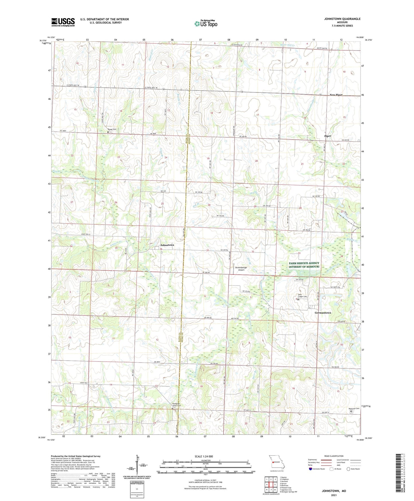
2021 topographic map quadrangle Johnstown in the state of Missouri. Scale: 1:24000. Based on the newly updated USGS 7.5' US Topo map series, this map is in the following counties: Henry, Bates. The map contains contour data, water features, and other items you are used to seeing on USGS maps, but also has updated roads and other features. This is the next generation of topographic maps. Printed on high-quality waterproof paper with UV fade-resistant inks.
Quads adjacent to this one:
West: Spruce
Northwest: Dayton
North: Creighton
Northeast: Hartwell
East: Montrose
Southeast: Monegaw Springs NW
South: Appleton City
Southwest: Pleasant Gap
Contains the following named places: American School, Antioch Creek, Aurora School, Brownsberger Airport, Davis Branch, Elm Branch, Enterprise School, Germantown, Grange Hall School, Horn Branch, Johnstown, Johnstown School, Long Branch, Maple Grove School, Montrose Cemetery, New Piper, Newberry Branch, North Deepwater Creek, Piper, Pleasant Home Church, Poage Cemetery, Poage Creek, Saint Ludger Cemetery, Saint Ludger Church, Snodgrass Union Cemetery, Soap Creek, South Deepwater Creek, Township of Deepwater, Township of Walker, White Oak Church, White Oak School, Willow Tree School