MyTopo
Monegaw Springs NW Missouri US Topo Map
Couldn't load pickup availability
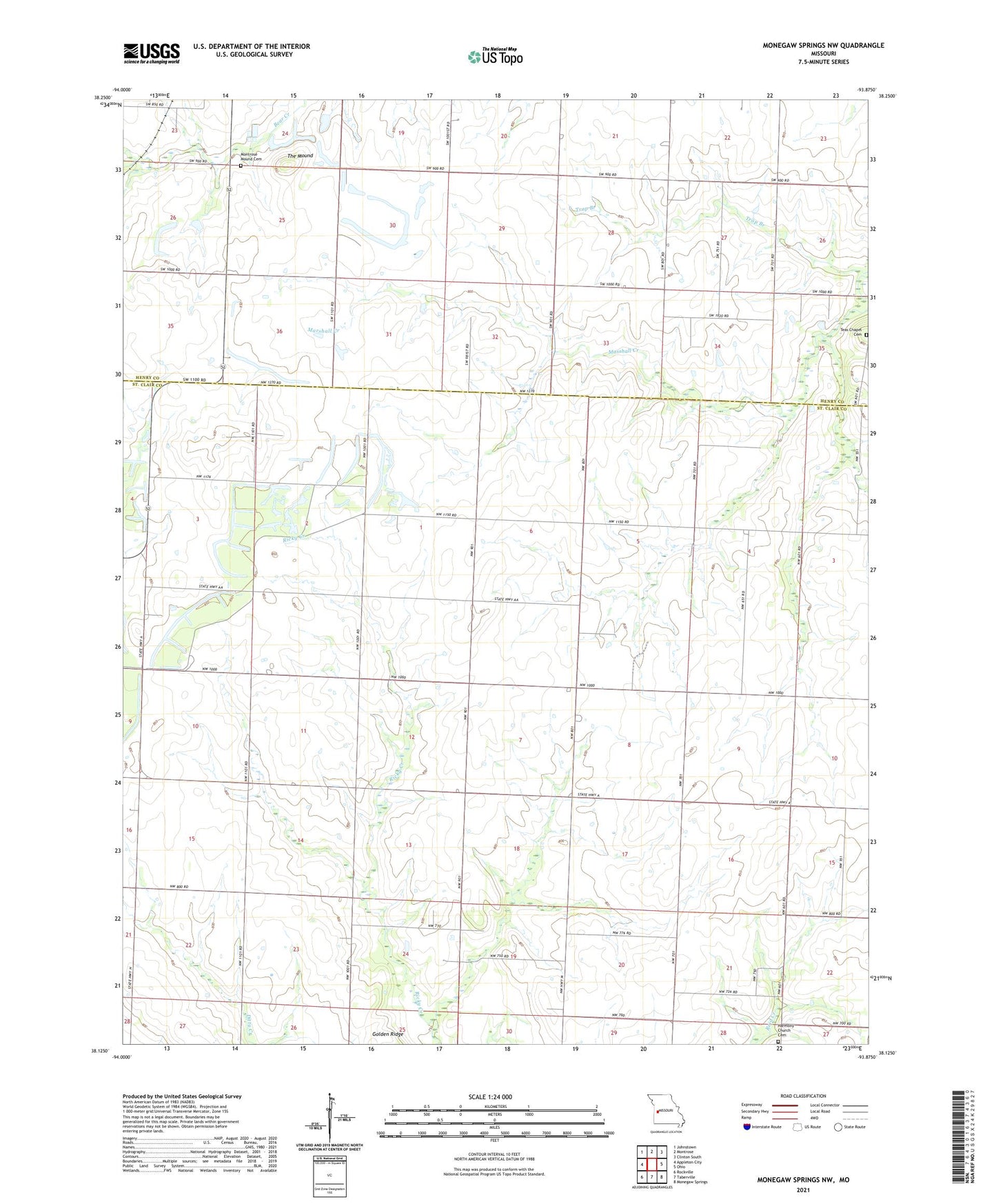
2021 topographic map quadrangle Monegaw Springs NW in the state of Missouri. Scale: 1:24000. Based on the newly updated USGS 7.5' US Topo map series, this map is in the following counties: St. Clair, Henry. The map contains contour data, water features, and other items you are used to seeing on USGS maps, but also has updated roads and other features. This is the next generation of topographic maps. Printed on high-quality waterproof paper with UV fade-resistant inks.
Quads adjacent to this one:
West: Appleton City
Northwest: Johnstown
North: Montrose
Northeast: Clinton South
East: Ohio
Southeast: Monegaw Springs
South: Taberville
Southwest: Rockville
This map covers the same area as the classic USGS quad with code o38093b8.
Contains the following named places: Antioch School, Appleton Center School, Centenial School, Center School, Copeland, Copeland Post Office, Francis School, Harmony Church Cemetery, Lookout School, Moore School, Pleasant Grove School, Potts School, Shoe School, Teays Chapel, The Mound, Township of Appleton, Township of Monegaw, Wagner School, Wheatley Colored School, White Hall School