MyTopo
Montrose Missouri US Topo Map
Couldn't load pickup availability
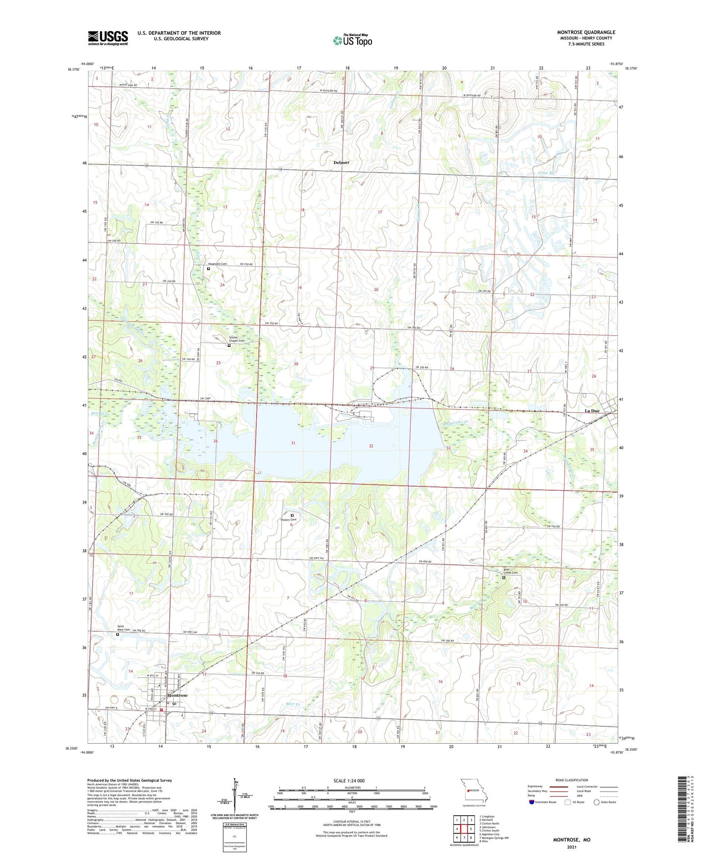
2021 topographic map quadrangle Montrose in the state of Missouri. Scale: 1:24000. Based on the newly updated USGS 7.5' US Topo map series, this map is in the following counties: Henry. The map contains contour data, water features, and other items you are used to seeing on USGS maps, but also has updated roads and other features. This is the next generation of topographic maps. Printed on high-quality waterproof paper with UV fade-resistant inks.
Quads adjacent to this one:
West: Johnstown
Northwest: Creighton
North: Hartwell
Northeast: Clinton North
East: Clinton South
Southeast: Ohio
South: Monegaw Springs NW
Southwest: Appleton City
This map covers the same area as the classic USGS quad with code o38093c8.
Contains the following named places: Bear Creek Cemetery, Bear Creek Chapel, Brushy Creek, Calhoun Landing Strip, Camp Branch School, Camp Creek, City of Montrose, Cleveland School, Davis Elementary School, Delmar, Elm Branch School, Farmers Institute, Franklin School, Glenwood School, Granddaddy Creek, Hopewell Cemetery, Hopewell-Cumberland Church, La Due, Lonevalle School, Montrose, Montrose Conservation Area, Montrose Elementary School, Montrose High School, Montrose Lake, Montrose Lake Dam, Montrose Police Department, Montrose Post Office, Montrose School, Montrose Volunteer Fire Department, Morris Mine, Mound School, Mount Carmel School, Mount Hope School, Saint Mary Cemetery, Stones Chapel, Township of Bear Creek, Township of Davis, Vickers Cemetery, Village of La Due, Willow Branch, Willow Branch School, ZIP Code: 64770