MyTopo
Creighton Missouri US Topo Map
Couldn't load pickup availability
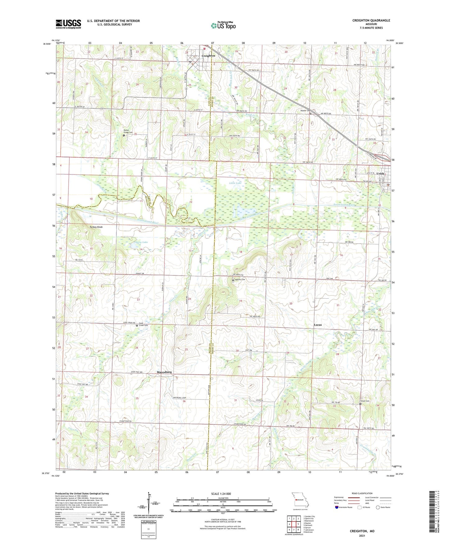
2021 topographic map quadrangle Creighton in the state of Missouri. Scale: 1:24000. Based on the newly updated USGS 7.5' US Topo map series, this map is in the following counties: Henry, Bates, Cass. The map contains contour data, water features, and other items you are used to seeing on USGS maps, but also has updated roads and other features. This is the next generation of topographic maps. Printed on high-quality waterproof paper with UV fade-resistant inks.
Quads adjacent to this one:
West: Dayton
Northwest: Garden City
North: Quick City
Northeast: Blairstown
East: Hartwell
Southeast: Montrose
South: Johnstown
Southwest: Spruce
This map covers the same area as the classic USGS quad with code o38094d1.
Contains the following named places: Black Oak Creek, City of Creighton, Clear Lake, Cove Creek, Cove Creek Cemetery, Cove Creek Church, Creighton, Creighton Fire Protection District, Creighton Post Office, Creighton School, Creighton Wastewater Treatment Facility, Fewel Cemetery, Greasy Creek, Greasy School, Hackley School, Hogard Creek, Kepner Cemetery, Knob Creek, Little Lake, Lucas, Mayesburg, Mullins Cemetery, Oak Grove School, Parker - Gregg Cemetery, Smokey Row Settlement, Smoky Row School, Sprig Lake, Township of Mingo, Township of White Oak, Turkey Knob, Urich, Urich Police Department, Urich Post Office, Willow Branch, ZIP Code: 64788