MyTopo
Kenoma Missouri US Topo Map
Couldn't load pickup availability
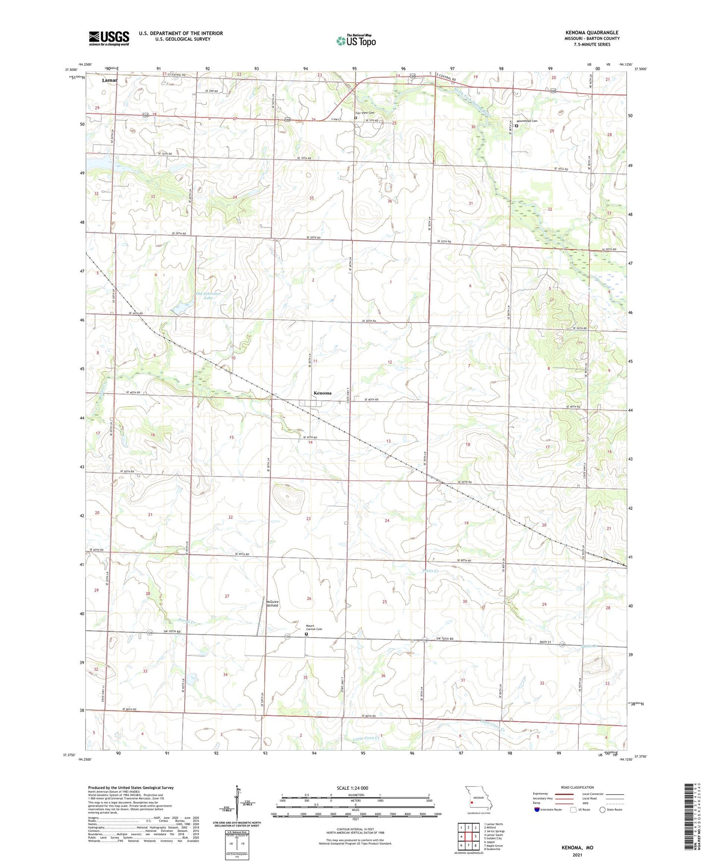
2021 topographic map quadrangle Kenoma in the state of Missouri. Scale: 1:24000. Based on the newly updated USGS 7.5' US Topo map series, this map is in the following counties: Barton. The map contains contour data, water features, and other items you are used to seeing on USGS maps, but also has updated roads and other features. This is the next generation of topographic maps. Printed on high-quality waterproof paper with UV fade-resistant inks.
Quads adjacent to this one:
West: Lamar South
Northwest: Lamar North
North: Milford
Northeast: Jerico Springs
East: Golden City
Southeast: Dudenville
South: Maple Grove
Southwest: Jasper
Contains the following named places: Bentlages Lake, Bushnell, Dorris Valley School, Fair View Cemetery, Fairview School, Forest Grove School, Glendale School, Golden Grove, Kenoma, Kenoma Census Designated Place, Kenoma School, McGuire Airfield, Montrose School, Morehead Church, Mount Carmel Cemetery, Mount Carmel Church, Mount Carmel School, Number 700 Dam, Number 704 Dam, Old Schreiner Lake, Sagehorn Lake Dam, Sherwood, Star Valley School, Stone School, Township of Golden City, Township of Richland, West Point School