MyTopo
Lamar North Missouri US Topo Map
Couldn't load pickup availability
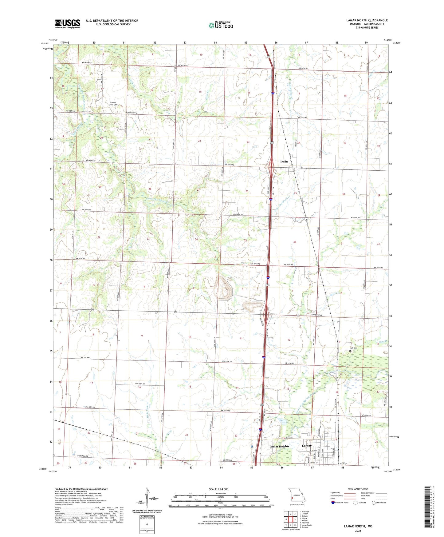
2021 topographic map quadrangle Lamar North in the state of Missouri. Scale: 1:24000. Based on the newly updated USGS 7.5' US Topo map series, this map is in the following counties: Barton. The map contains contour data, water features, and other items you are used to seeing on USGS maps, but also has updated roads and other features. This is the next generation of topographic maps. Printed on high-quality waterproof paper with UV fade-resistant inks.
Quads adjacent to this one:
West: Iantha
Northwest: Bronaugh
North: Sheldon
Northeast: Bellamy
East: Milford
Southeast: Kenoma
South: Lamar South
Southwest: Nashville
This map covers the same area as the classic USGS quad with code o37094e3.
Contains the following named places: Bakers Grove Cemetery, Bakers Grove School, Barton County, Bucks Run Creek, Caput School, Central Chapel, Central School, Cox Barton County Hospital, Curless Lake Dam, Don Bunton Dam, Earl Dumm Dam, Elm Branch, Fairbanks, Fairbanks Post Office, Haines Grove School, Hornaday, Irwin, Irwin Census Designated Place, Irwin School, Lamar Area Vocational-Technical School, Lamar Elementary School, Lamar High School, Nigh Cemetery, Ozark School, Rockdale School, Shady Grove School, Township of Lamar, Township of Union, ZIP Code: 64759