MyTopo
Milford Missouri US Topo Map
Couldn't load pickup availability
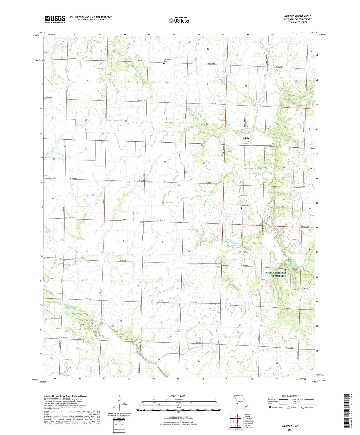
2021 topographic map quadrangle Milford in the state of Missouri. Scale: 1:24000. Based on the newly updated USGS 7.5' US Topo map series, this map is in the following counties: Barton. The map contains contour data, water features, and other items you are used to seeing on USGS maps, but also has updated roads and other features. This is the next generation of topographic maps. Printed on high-quality waterproof paper with UV fade-resistant inks.
Quads adjacent to this one:
West: Lamar North
Northwest: Sheldon
North: Bellamy
Northeast: Montevallo
East: Jerico Springs
Southeast: Golden City
South: Kenoma
Southwest: Lamar South
This map covers the same area as the classic USGS quad with code o37094e2.
Contains the following named places: Anderson School, Bethany Church, Cass Dam, Cass Lake, Charles Wood Dam, Cherry Grove School, City View School, Cold Branch, Cook Cemetery, Doylesport Cemetery, Doylesport School, Emberry Lake, Embery Lake Dam, Friendship School, Harmony School, Hopewell Church, Howell Cemetery, Hyder Branch, Milford, Milford School, Painter Branch, Prairie Rose School, Ring Branch, Summit School, Township of Doylesport, Valley School, Victory School, Village of Milford, Wood Lake, Wood Lake Dam