MyTopo
Kingdom City Missouri US Topo Map
Couldn't load pickup availability
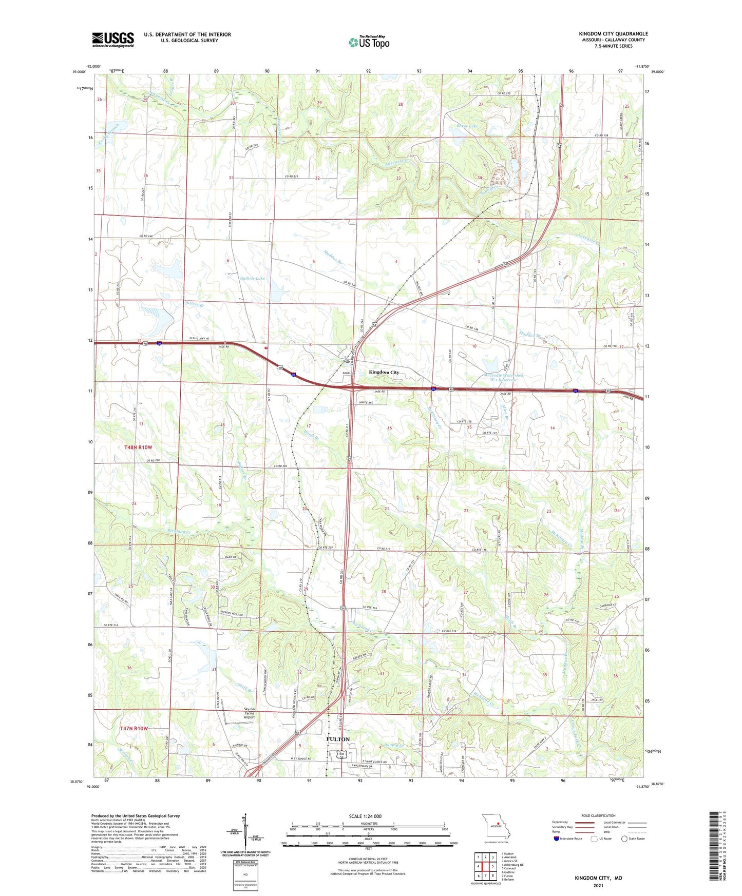
2021 topographic map quadrangle Kingdom City in the state of Missouri. Scale: 1:24000. Based on the newly updated USGS 7.5' US Topo map series, this map is in the following counties: Callaway. The map contains contour data, water features, and other items you are used to seeing on USGS maps, but also has updated roads and other features. This is the next generation of topographic maps. Printed on high-quality waterproof paper with UV fade-resistant inks.
Quads adjacent to this one:
West: Millersburg NE
Northwest: Hatton
North: Auxvasse
Northeast: Mexico SE
East: Calwood
Southeast: Reform
South: Fulton
Southwest: Guthrie
Contains the following named places: Allen Branch, Atkinson Lake Dam, Atkinson School, Backer Dam, Baker Lake, Baker Lake Dam, Borman Lake Dam, Bynum Creek, Callaway, Craig School, Dorsey School, Ebenezer Church, Guthrie Lake, Guthrie Lake Dam, Hardin School, Houfs Branch, Kingdom City, Kingdom City Post Office, Leeper Branch, Lehenbaur Lake Section 25 Dam, Maddox Branch, Maddox School, Martien School, McCredie, McCredie Experiment Station Dam, McCredie Watershed W-1 Reservoir, McKinney Creek, North Callaway Fire Protection District Station 1, North Callaway High School, Renner Dam, Richland Church, Richland Creek, Rocky Branch, Saint Eunice School, Sallees Branch, Sky-Go Farms Airport, Township of McCredie, Village of Kingdom City, ZIP Code: 65262