MyTopo
Kingsville Missouri US Topo Map
Couldn't load pickup availability
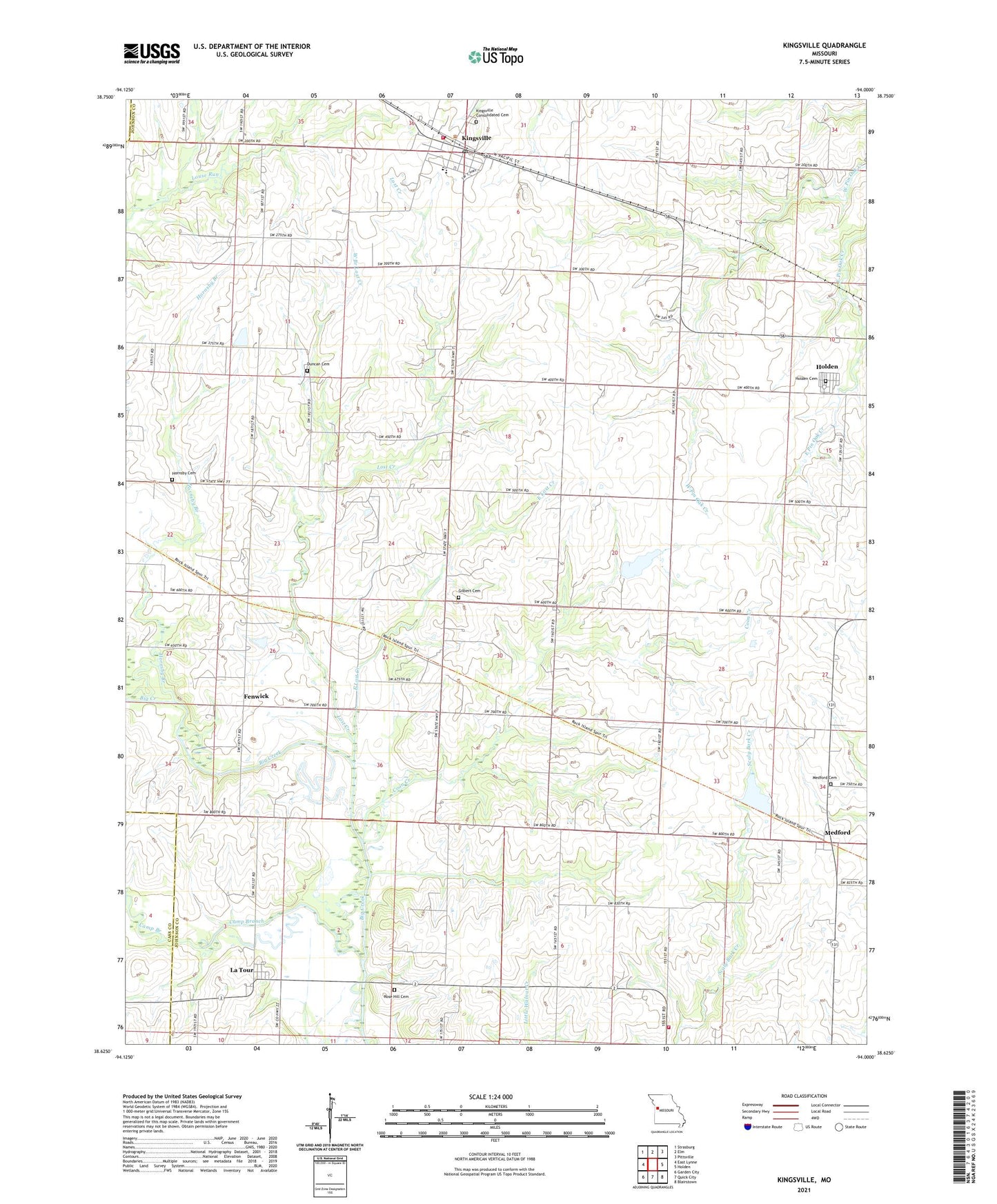
2021 topographic map quadrangle Kingsville in the state of Missouri. Scale: 1:24000. Based on the newly updated USGS 7.5' US Topo map series, this map is in the following counties: Johnson, Cass. The map contains contour data, water features, and other items you are used to seeing on USGS maps, but also has updated roads and other features. This is the next generation of topographic maps. Printed on high-quality waterproof paper with UV fade-resistant inks.
Quads adjacent to this one:
West: East Lynne
Northwest: Strasburg
North: Elm
Northeast: Pittsville
East: Holden
Southeast: Blairstown
South: Quick City
Southwest: Garden City
Contains the following named places: Camp Branch, City of Kingsville, Coon Creek, Duncan Cemetery, Duncan School, East Lost Creek, Eldridge Lake, Eldridge Lake Dam, Fender J H Airport, Fenwick, Gilbert Cemetery, Hartman Lake Dam, Holden Cemetery, Hornsby Branch, Hornsby Cemetery, Johnson County Fire Protection District 2 Station 1 Kingsville Headquarters, Johnson County Fire Protection District 2 Station 4 Rose Hill, Johnson E-24 Lake, Jurden School, Kestersen Lake, Kesterson Dam, Kingsville, Kingsville Consolidated Cemetery, Kingsville Elementary School, Kingsville High School, Kingsville Post Office, La Tour Census Designated Place, Latour, Latour School, Lenny Lake Dam, Lost Creek, McCannon Lake Dam, Medford, Medford Cemetery, Number 201 Reservoir, Olive Hill Post Office, Pleasant View School, Rock Island Lake, Rock Island Lake Dam, Rose Hill, Rose Hill Cemetery, Scaley Bark School, South Fork Blackwater River Watershed Dam E-24, Stout School, Township of Kingsville, Village of La Tour, West Branch Lost Creek