MyTopo
Blairstown Missouri US Topo Map
Couldn't load pickup availability
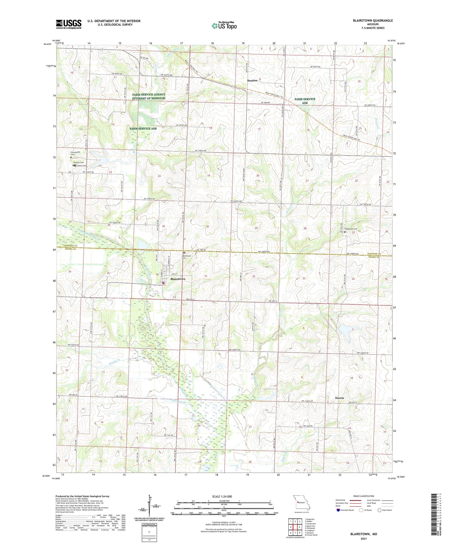
2021 topographic map quadrangle Blairstown in the state of Missouri. Scale: 1:24000. Based on the newly updated USGS 7.5' US Topo map series, this map is in the following counties: Henry, Johnson. The map contains contour data, water features, and other items you are used to seeing on USGS maps, but also has updated roads and other features. This is the next generation of topographic maps. Printed on high-quality waterproof paper with UV fade-resistant inks.
Quads adjacent to this one:
West: Quick City
Northwest: Kingsville
North: Holden
Northeast: Centerview
East: Chilhowee
Southeast: Clinton North
South: Hartwell
Southwest: Creighton
This map covers the same area as the classic USGS quad with code o38093e8.
Contains the following named places: Bear Creek, Bear Creek Church, Blairstown, Blairstown Cemetery, Blairstown Post Office, Blairstown School, Blairstown Volunteer Fire Department, Brushy Church, Brushy Creek, Brushy School, Carpenter Cemetery, City of Blairstown, Compromise School, Denton, Denton School, Eliza ann Branch, Farnsworth Cemetery, Landis, Norris, Norris Creek, Norris School, Old Channel Big Creek, Priestly Cemetery, Quick Cemetery, Star School, Township of Big Creek, ZIP Code: 64726