MyTopo
Garden City Missouri US Topo Map
Couldn't load pickup availability
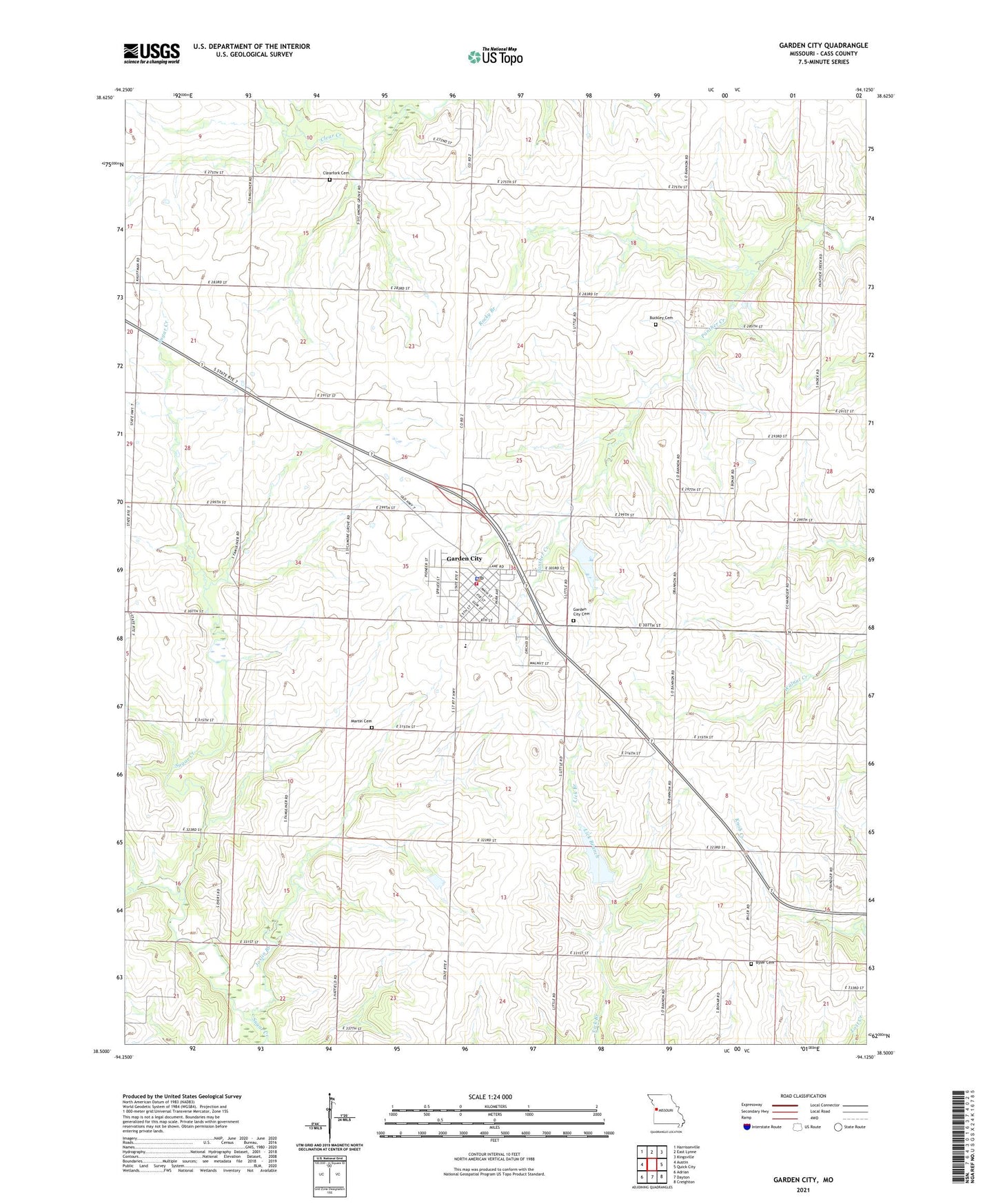
2021 topographic map quadrangle Garden City in the state of Missouri. Scale: 1:24000. Based on the newly updated USGS 7.5' US Topo map series, this map is in the following counties: Cass. The map contains contour data, water features, and other items you are used to seeing on USGS maps, but also has updated roads and other features. This is the next generation of topographic maps. Printed on high-quality waterproof paper with UV fade-resistant inks.
Quads adjacent to this one:
West: Austin
Northwest: Harrisonville
North: East Lynne
Northeast: Kingsville
East: Quick City
Southeast: Creighton
South: Dayton
Southwest: Adrian
This map covers the same area as the classic USGS quad with code o38094e2.
Contains the following named places: Breed Ranch Airport, Brown School, Buckley Cemetery, Byler Cemetery, City of Garden City, Clearfork Cemetery, Clearfork School, Farmers View School, Garden City, Garden City Cemetery, Garden City Fire Protection District, Garden City Lake Dam, Garden City Police Department, Garden City Post Office, Garden City School, Garden City Wastewater Treatment Facility, Index, Index School, Ivy Wall Lake Dam, Joslin Branch, Martin Cemetery, Number Eight School, Number Nine School, Peach Grove School, Rockford, Rocky Branch, Schrock Lake, Schrock Lake Dam, Schuyler School, Sugar Creek School, Sycamore Grove Church, Township of Dayton, Township of Index, Training Center Christian School, Wallace School, ZIP Code: 64747