MyTopo
Knoxville Missouri US Topo Map
Couldn't load pickup availability
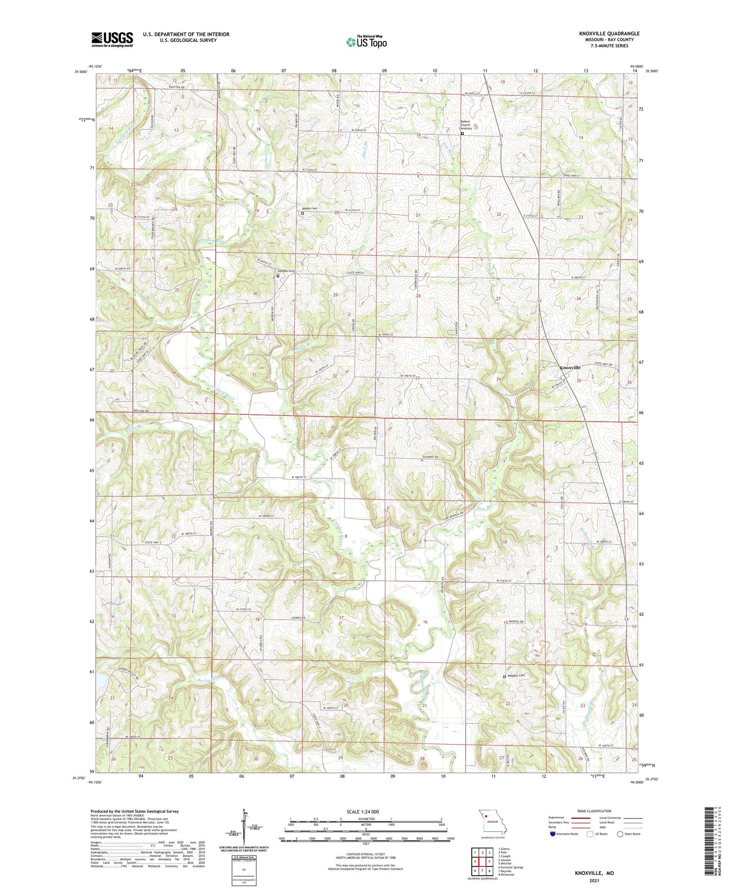
2021 topographic map quadrangle Knoxville in the state of Missouri. Scale: 1:24000. Based on the newly updated USGS 7.5' US Topo map series, this map is in the following counties: Ray. The map contains contour data, water features, and other items you are used to seeing on USGS maps, but also has updated roads and other features. This is the next generation of topographic maps. Printed on high-quality waterproof paper with UV fade-resistant inks.
Quads adjacent to this one:
West: Lawson
Northwest: Elmira
North: Polo
Northeast: Cowgill
East: Millville
Southeast: Richmond
South: Rayville
Southwest: Excelsior Springs
Contains the following named places: Bethel Church, Bethlehem Church, Bisbee Lake Dam, Cockerel Creek, Coon Branch, Crenshaw School, Davis Branch, Fairplay School, Fire Branch, Hidden Valley Subdivision Lake Dam, Kings Branch, Knoxville, Koetting Lake Dam, Loyd School, Maddux Cemetery, Marion School, Mayes Cemetery, Murray School, Pleasant Valley School, Rocky Fork School, Sandals, Sandals Cemetery, Taylor School, Township of Knoxville, Union Church, ZIP Code: 64084