MyTopo
Lanton Missouri US Topo Map
Couldn't load pickup availability
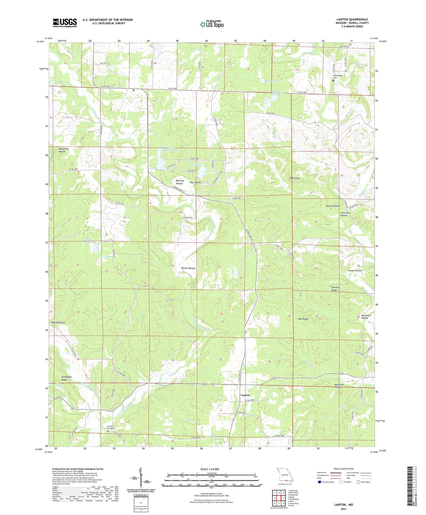
2021 topographic map quadrangle Lanton in the state of Missouri. Scale: 1:24000. Based on the newly updated USGS 7.5' US Topo map series, this map is in the following counties: Howell. The map contains contour data, water features, and other items you are used to seeing on USGS maps, but also has updated roads and other features. This is the next generation of topographic maps. Printed on high-quality waterproof paper with UV fade-resistant inks.
Quads adjacent to this one:
West: Moody
Northwest: South Fork
North: West Plains
Northeast: Brandsville
East: Koshkonong
Southeast: Camp
South: Salem Knob
Southwest: Viola
Contains the following named places: Adobesee Pond, Alter Dam, Ball Branch, Brent Lake, Brent Lake Dam, Bunt Spring, Byler Lake Dam, Cannon Graveyard, Clyde Stewart Lake, Devils Den, Dividing Ridge, Doty School, Elkhorn Branch, Fruitville, Fruitville School, Globe, Globe Post Office, Gordon Branch, Hatfield School, Hay Hollow, Highland Park Church, Hopewell School, House Hollow, Hunt Branch, Lanton, Lanton School, Lanton Volunteer Fire Department, Leo, Leo Post Office, Lime Kiln Hollow, Matne Hollow, McGinty Hollow, Meltabarger Cemetery, Meredith Hollow, Middle Ridge, Mott, Mott School, Myatt Pond, Stace Shannon Lake Dam, Stace-Shannon Lake, Stuart Hollow, Sycamore Hollow, Tingler Lake, Township Line Church, Township Line School, West Fork Spring Creek, White River State Forest, Wilson Hollow