MyTopo
Viola Arkansas US Topo Map
Couldn't load pickup availability
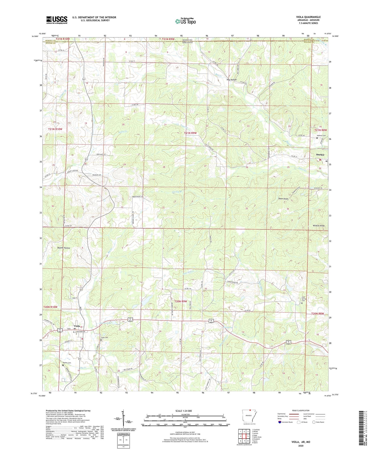
2024 topographic map quadrangle Viola in the state of Arkansas. Scale: 1:24000. Based on the newly updated USGS 7.5' US Topo map series, this map is in the following counties: Fulton, Howell. The map contains contour data, water features, and other items you are used to seeing on USGS maps, but also has updated roads and other features. This is the next generation of topographic maps. Printed on high-quality waterproof paper with UV fade-resistant inks.
Quads adjacent to this one:
West: Gepp
Northwest: Caulfield
North: Moody
Northeast: Lanton
East: Salem Knob
Southeast: Salem
South: Byron
Southwest: Elizabeth
Contains the following named places: Barker Cemetery, Bay Creek Church, Davenport Creek, Flint Spring, Flint Spring Church, Flint Springs, Greasy Branch, Gum Spring Cemetery, Gum Spring Church, Hay Hollow, James Lake, James Lake Dam Number One, Lake Leon, Lake Leon Dam, Liberty Hill School, Mount Calm Church, Shaw Knob, Sparks Lake, Sparks Lake Dam, Spring Lake, Spring Lake Dam, Sturkie Post Office, Sturkie Rural Volunteer Fire Department, Town of Viola, Township of Fulton, Township of Mount Calm, Viola, Viola Cemetery, Viola Elementary School, Viola High School, Viola Post Office, Viola Volunteer Fire Department, Watkins Cemetery, Wildcat Knob, ZIP Codes: 72578, 72583