MyTopo
South Fork Missouri US Topo Map
Couldn't load pickup availability
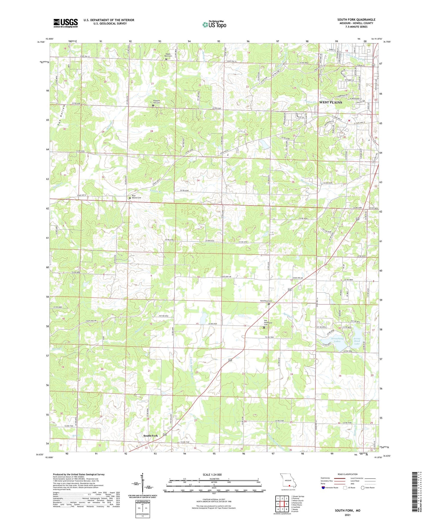
2021 topographic map quadrangle South Fork in the state of Missouri. Scale: 1:24000. Based on the newly updated USGS 7.5' US Topo map series, this map is in the following counties: Howell. The map contains contour data, water features, and other items you are used to seeing on USGS maps, but also has updated roads and other features. This is the next generation of topographic maps. Printed on high-quality waterproof paper with UV fade-resistant inks.
Quads adjacent to this one:
West: Pottersville
Northwest: Siloam Springs
North: Pomona
Northeast: White Church
East: West Plains
Southeast: Lanton
South: Moody
Southwest: Caulfield
This map covers the same area as the classic USGS quad with code o36091f8.
Contains the following named places: Arrow Head Lake, Arrowhead Lakes, Blue Mound Cemetery, Blue Mound School, Bradford School, Cedar Grove School, Center of God Church, Center School, Fairview School, Forrest Branch, Grisham Lake, Grisham Lake Dam, Hayden Callahan Dam, Hill Crest Church, Homeland, Homeland Cemetery, Homeland Church, Homeland School, Hope Rest Church, Howell County Rural Fire District Station 1, Howell County Rural Fire District Station 2, KKDY-FM (West Plains), KSPQ-FM (West Plains), Oak Ridge School, Old Homeland Cemetery, Pleasant Hill Cemetery, Pleasant Hill Church, Renfrow School, Rock Valley School, South Fork, South Fork Census Designated Place, Spring Creek Church, Stokes Lake Number 1 Dam, Stokes Number 2 Dam