MyTopo
Moody Missouri US Topo Map
Couldn't load pickup availability
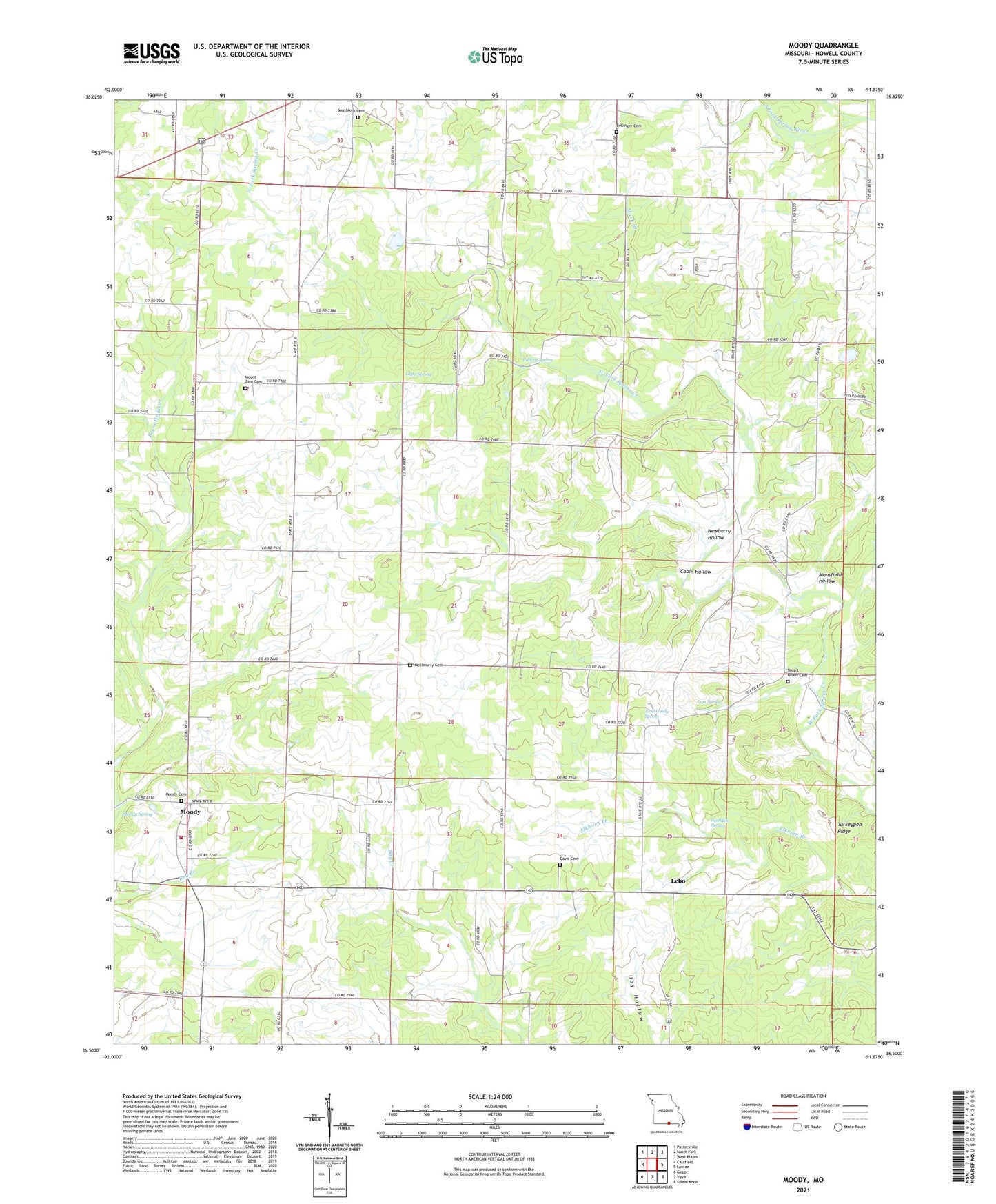
2021 topographic map quadrangle Moody in the state of Missouri. Scale: 1:24000. Based on the newly updated USGS 7.5' US Topo map series, this map is in the following counties: Howell. The map contains contour data, water features, and other items you are used to seeing on USGS maps, but also has updated roads and other features. This is the next generation of topographic maps. Printed on high-quality waterproof paper with UV fade-resistant inks.
Quads adjacent to this one:
West: Caulfield
Northwest: Pottersville
North: South Fork
Northeast: West Plains
East: Lanton
Southeast: Salem Knob
South: Viola
Southwest: Gepp
This map covers the same area as the classic USGS quad with code o36091e8.
Contains the following named places: Aunt Cindy Spring, Brown Chapel, Cabin Hollow, Center Grove Church, Cherry Spring, China, China Union Church, Davis Cemetery, Gladden Spring, Lapp Spring, Lebo, Lost Spring, Lost Spring School, Mansfield Hollow, McElmurry Cemetery, Monk Branch, Moody, Moody Census Designated Place, Moody Creek, Moody Spring, Moody Volunteer Fire Department, Mount Zion Cemetery, Mount Zion Church, Mount Zion School, Newberry Hollow, Oak Ridge School, Pitts Grove School, Spring Creek, Stuart Union Church, Township of South Fork, Turkeypen Ridge, Valley Star School, Willow Grove School, Wrights Mill, ZIP Code: 65777