MyTopo
Lindley Missouri US Topo Map
Couldn't load pickup availability
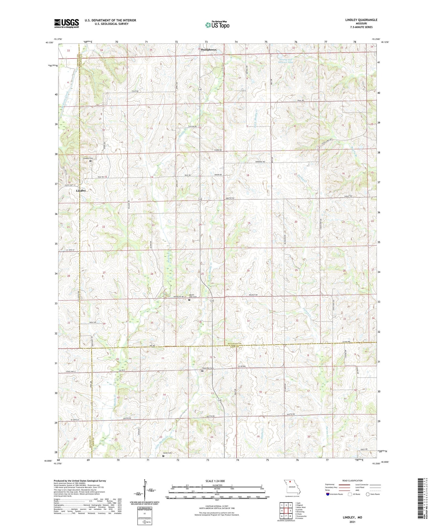
2021 topographic map quadrangle Lindley in the state of Missouri. Scale: 1:24000. Based on the newly updated USGS 7.5' US Topo map series, this map is in the following counties: Sullivan, Linn, Grundy. The map contains contour data, water features, and other items you are used to seeing on USGS maps, but also has updated roads and other features. This is the next generation of topographic maps. Printed on high-quality waterproof paper with UV fade-resistant inks.
Quads adjacent to this one:
West: Laredo
Northwest: Galt
North: Osgood
Northeast: Milan West
East: Browning
Southeast: Linneus
South: Eversonville
Southwest: Chula
Contains the following named places: Baker Lake, Baker Lake Dam, Climax School, Duffield School, Fairview School, Green Valley School, Hamilton School, Haseville, Haseville Cemetery, Haseville Church, Lindley, Lindley Cemetery, Lindley School, Mount Zion Cemetery, Mount Zion Church, North Bethel School, Parsons, Russell School, Smith Cemetery, Strong and Stewart Lake, Strong and Stewart Lake Dam, Township of Taylor, Whaley School, ZIP Code: 64646