MyTopo
Galt Missouri US Topo Map
Couldn't load pickup availability
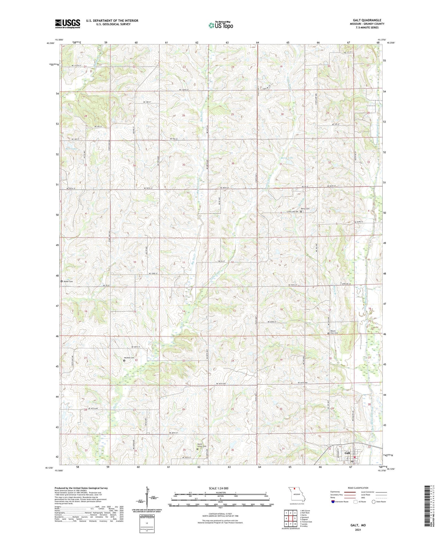
2021 topographic map quadrangle Galt in the state of Missouri. Scale: 1:24000. Based on the newly updated USGS 7.5' US Topo map series, this map is in the following counties: Grundy. The map contains contour data, water features, and other items you are used to seeing on USGS maps, but also has updated roads and other features. This is the next generation of topographic maps. Printed on high-quality waterproof paper with UV fade-resistant inks.
Quads adjacent to this one:
West: Spickard
Northwest: Mill Grove
North: Half Rock
Northeast: Harris
East: Osgood
Southeast: Lindley
South: Laredo
Southwest: Trenton East
This map covers the same area as the classic USGS quad with code o40093b4.
Contains the following named places: Berry Cemetery, Berry Church, Berry Lake, Berry Lake Dam, Berry School, Big No Creek, Birch Branch, Bolser Cemetery, Bunnell School, City of Galt, East Fairview School, Fairview Church, Ford School, Galt, Galt Fire Protection District, Galt Post Office, Grundy County High School, Herrold Lake Dam, Little No Creek, McAfee Cemetery, Meighn Lake Dam, Mount Zion Cemetery, Mount Zion Church, Mount Zion School, Mud College School, Myersville School, No Creek School, North Union Cemetery, Parr Dam, Parr Lake, Robert Russ Dam, Robert Russ Lake, Starlight Church, Starlight School, Township of Liberty, Township of Myers, ZIP Code: 64641