MyTopo
Chula Missouri US Topo Map
Couldn't load pickup availability
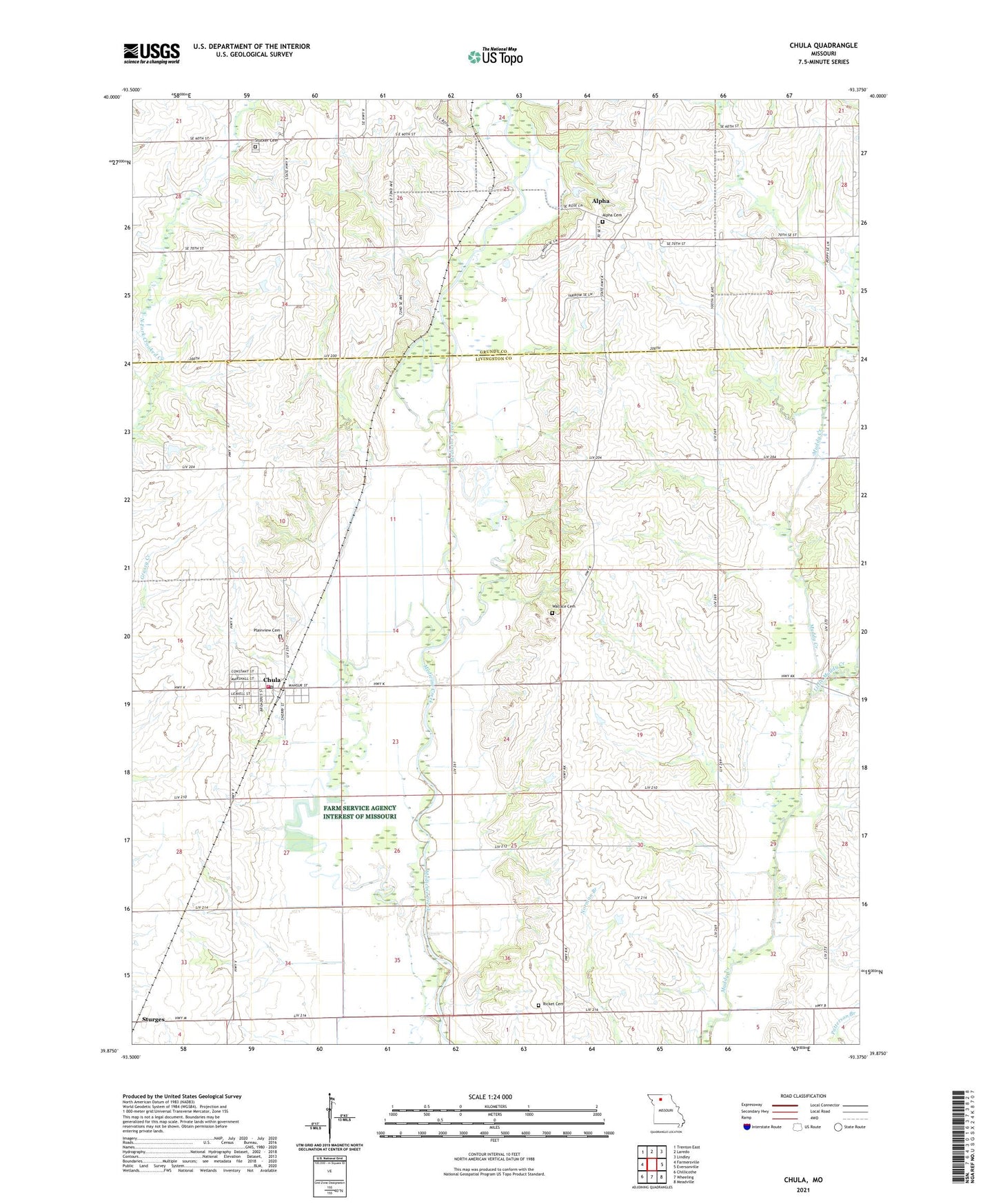
2021 topographic map quadrangle Chula in the state of Missouri. Scale: 1:24000. Based on the newly updated USGS 7.5' US Topo map series, this map is in the following counties: Livingston, Grundy. The map contains contour data, water features, and other items you are used to seeing on USGS maps, but also has updated roads and other features. This is the next generation of topographic maps. Printed on high-quality waterproof paper with UV fade-resistant inks.
Quads adjacent to this one:
West: Farmersville
Northwest: Trenton East
North: Laredo
Northeast: Lindley
East: Eversonville
Southeast: Meadville
South: Wheeling
Southwest: Chillicothe
This map covers the same area as the classic USGS quad with code o39093h4.
Contains the following named places: Alpha, Alpha Cemetery, Chula, Chula Post Office, Chula Rural Fire District, City of Chula, Gordonville School, Harmony, Little Muddy Creek, Livingston County Elementary School, Manning School, Maple Grove School, Mount Gilead School, Mount Vernon School, Niantic, Phillip School, Plainview Cemetery, Ricket Cemetery, Smith School, Stucker Cemetery, Township of Medicine, Township of Wilson, Wallace Cemetery, ZIP Code: 64635