MyTopo
Lone Elm Missouri US Topo Map
Couldn't load pickup availability
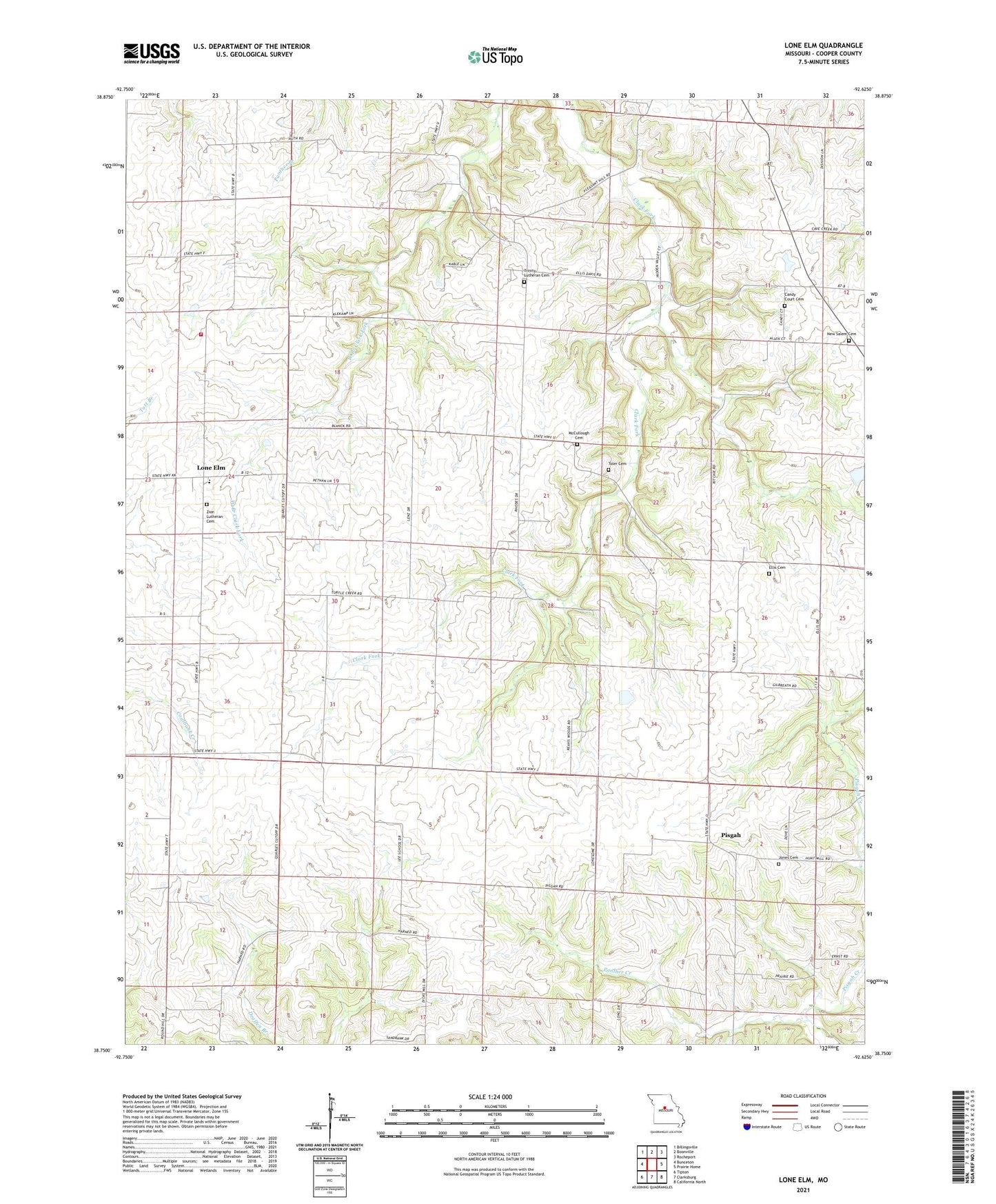
2021 topographic map quadrangle Lone Elm in the state of Missouri. Scale: 1:24000. Based on the newly updated USGS 7.5' US Topo map series, this map is in the following counties: Cooper. The map contains contour data, water features, and other items you are used to seeing on USGS maps, but also has updated roads and other features. This is the next generation of topographic maps. Printed on high-quality waterproof paper with UV fade-resistant inks.
Quads adjacent to this one:
West: Bunceton
Northwest: Billingsville
North: Boonville
Northeast: Rocheport
East: Prairie Home
Southeast: California North
South: Clarksburg
Southwest: Tipton
This map covers the same area as the classic USGS quad with code o38092g6.
Contains the following named places: Davis School, Ellis Cemetery, Ellis School, Jefferson School, Jones Cemetery, Lee School, Lenz Lake Dam, Lone Elm, Lone Grove School, McCullough Cemetery, New Salem Cemetery, Panther Creek, Pisgah, Pisgah School, Pleasant Hill Church, Salemen School, Toler Cemetery, Township of Clark Fork, Township of North Moniteau, Trinity Church, Walnut Grove Church, Washington School