MyTopo
Rocheport Missouri US Topo Map
Couldn't load pickup availability
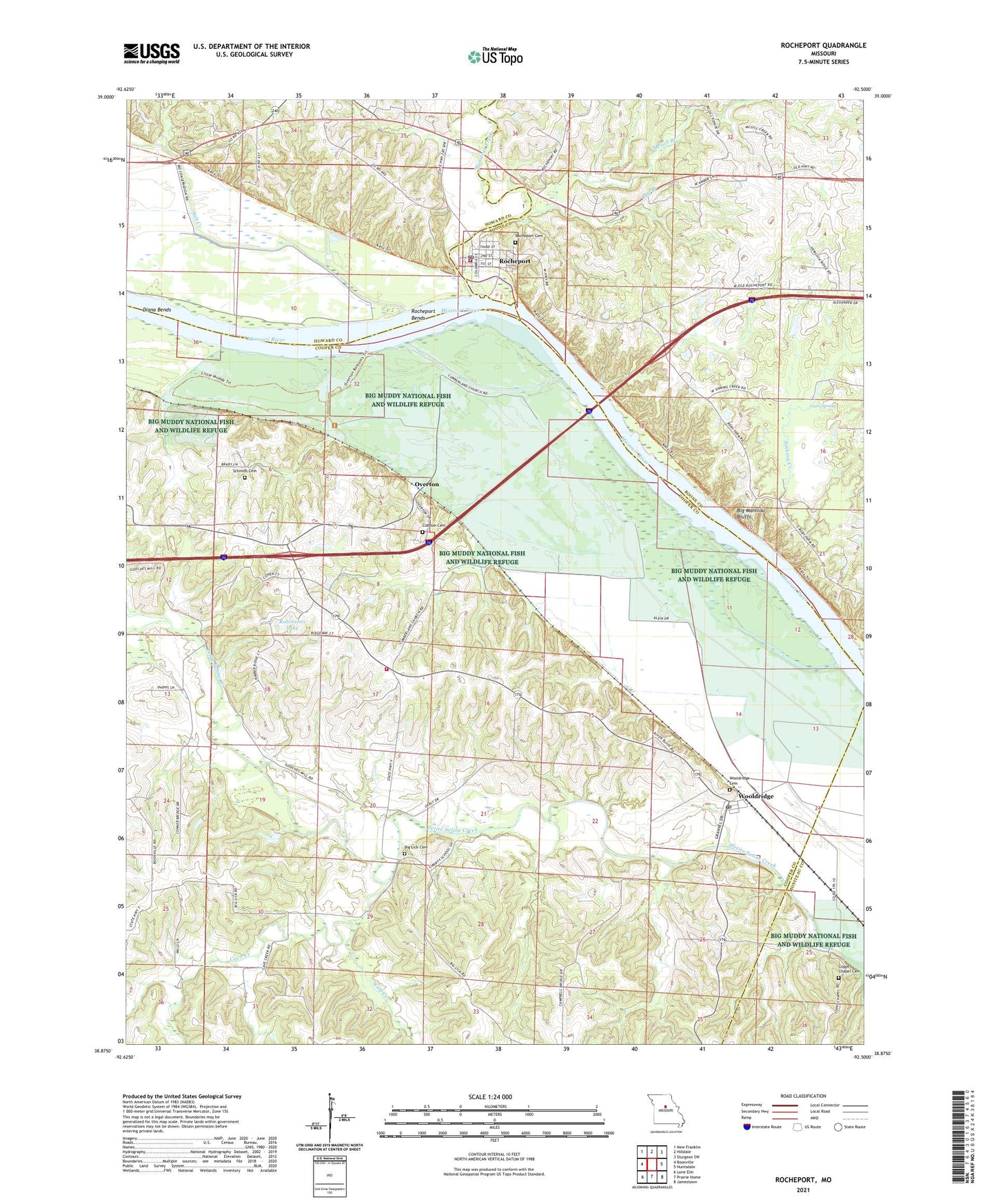
2021 topographic map quadrangle Rocheport in the state of Missouri. Scale: 1:24000. Based on the newly updated USGS 7.5' US Topo map series, this map is in the following counties: Cooper, Boone, Howard, Moniteau. The map contains contour data, water features, and other items you are used to seeing on USGS maps, but also has updated roads and other features. This is the next generation of topographic maps. Printed on high-quality waterproof paper with UV fade-resistant inks.
Quads adjacent to this one:
West: Boonville
Northwest: New Franklin
North: Hilldale
Northeast: Sturgeon SW
East: Huntsdale
Southeast: Jamestown
South: Prairie Home
Southwest: Lone Elm
This map covers the same area as the classic USGS quad with code o38092h5.
Contains the following named places: Bell Branch, Big Lick Cemetery, Big Manitou Bluffs, Big Muddy National Fish and Wildlife Refuge, Boone County Fire Protection District Station 2, Bruce School, Cave Creek, City of Rocheport, Clayton Cemetery, Cooper County Fire Protection District Station 3, Copp Chapel, Diana Bends, Gooch Mill, Gooch Mill Church, Gum Spring, Highland Church, Highland School, Liberty School, Linden School, Lowland School, McGill Branch, Moniteau Creek, Northern Ozarks, Oak Grove School, Overton, Overton Bottoms Conservation Area, Robinsons Dam, Robinsons Lake, Rocheport, Rocheport Bends, Rocheport Post Office, Salt Creek, Schmidt Cemetery, Sinking Creek, Taylor's Landing Access, Township of Saline, Village of Wooldridge, Wolf Creek, Wooldridge, Wooldridge Post Office, Wooldridge School, ZIP Code: 65287