MyTopo
Maitland Missouri US Topo Map
Couldn't load pickup availability
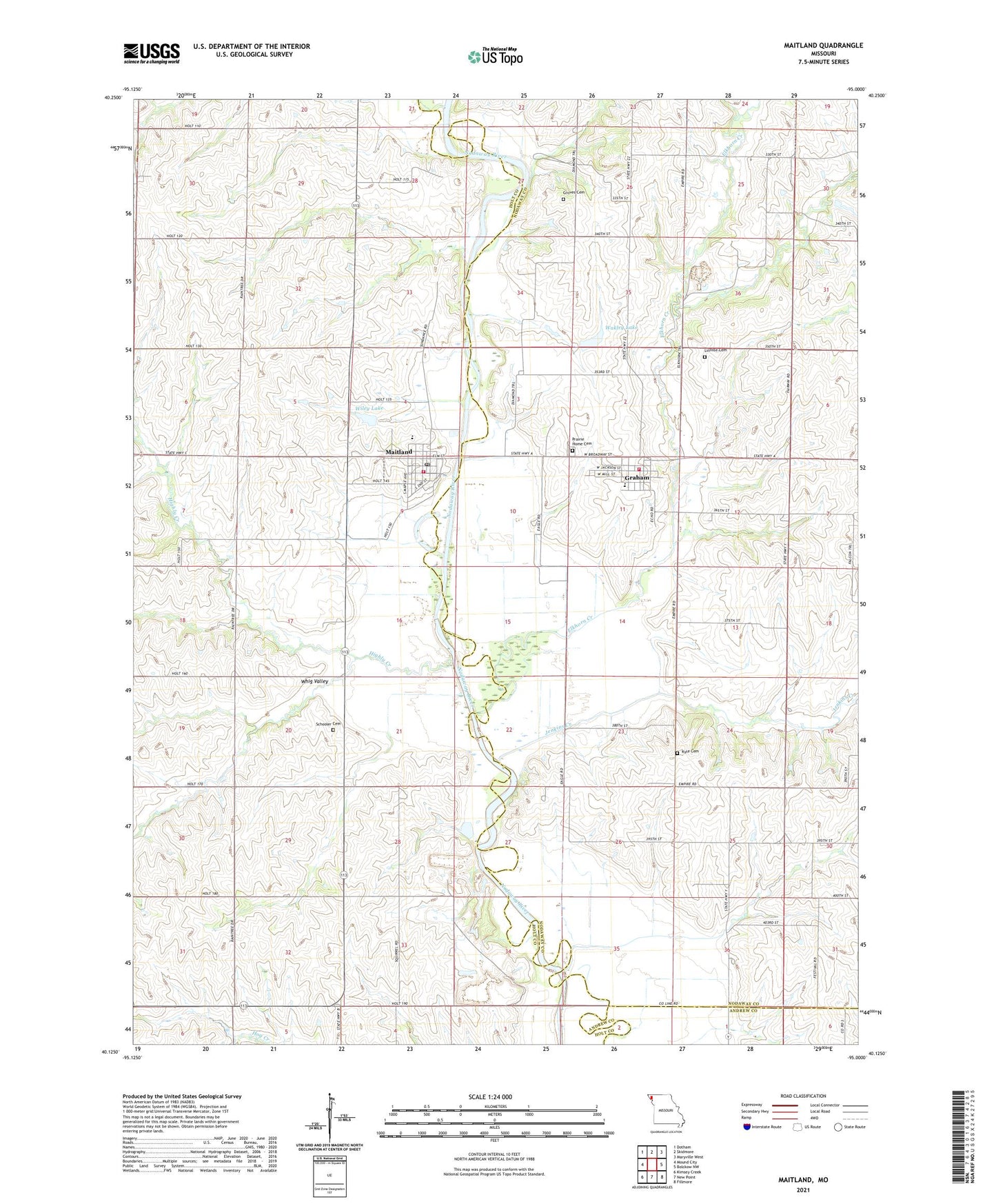
2021 topographic map quadrangle Maitland in the state of Missouri. Scale: 1:24000. Based on the newly updated USGS 7.5' US Topo map series, this map is in the following counties: Nodaway, Holt, Andrew. The map contains contour data, water features, and other items you are used to seeing on USGS maps, but also has updated roads and other features. This is the next generation of topographic maps. Printed on high-quality waterproof paper with UV fade-resistant inks.
Quads adjacent to this one:
West: Mound City
Northwest: Dotham
North: Skidmore
Northeast: Maryville West
East: Bolckow NW
Southeast: Fillmore
South: New Point
Southwest: Kimsey Creek
Contains the following named places: A-B-C-D Planning Region, Campbell Corner, City of Maitland, Elkhorn Creek, Elkhorn School, Eureka School, Graham, Graham Fire Protection District, Graham Post Office, Graham Quarry, Groves Cemetery, Hayzlett School, Hickory Grove School, Highly Creek, Jenkins Creek, Kinglewood Airport, Kings Grove, Kings Grove School, Kyle Cemetery, Linville Cemetery, Maitland, Maitland Post Office, Maitland Volunteer Fire Protection District, Nodaway - Holt Elementary School, Nodaway - Holt Junior Senior High School, Nodaway - Holt Middle School, Prairie Home Cemetery, Richland School, Rising Sun School, Schooler Cemetery, Town of Graham, Township of Clay, Wakley Lake, Wakley Lake Dam, Whig Valley, Wiley Lake, Wiley Lake Dam, ZIP Codes: 64455, 64466