MyTopo
Dotham Missouri US Topo Map
Couldn't load pickup availability
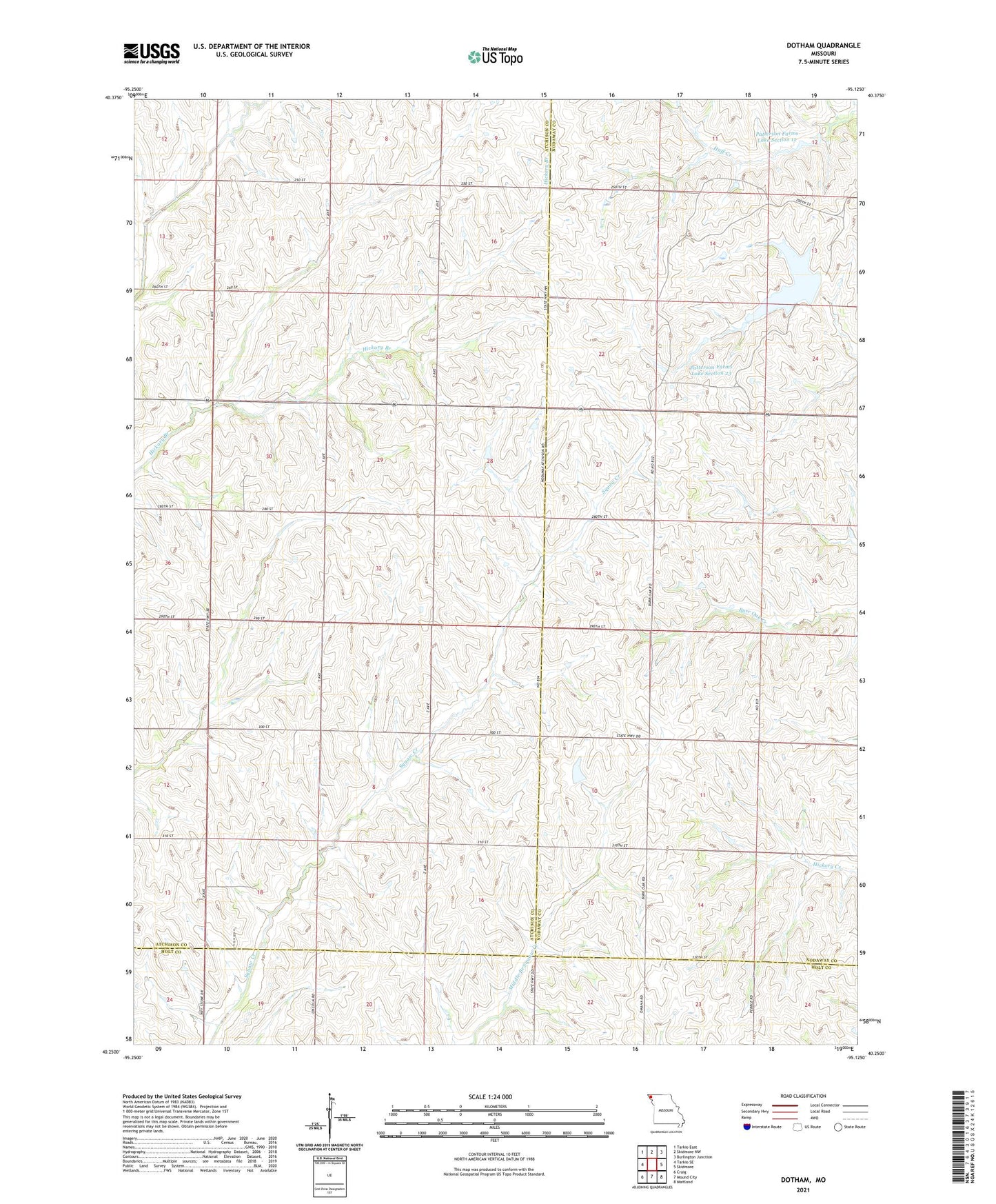
2023 topographic map quadrangle Dotham in the state of Missouri. Scale: 1:24000. Based on the newly updated USGS 7.5' US Topo map series, this map is in the following counties: Atchison, Nodaway, Holt. The map contains contour data, water features, and other items you are used to seeing on USGS maps, but also has updated roads and other features. This is the next generation of topographic maps. Printed on high-quality waterproof paper with UV fade-resistant inks.
Quads adjacent to this one:
West: Tarkio SE
Northwest: Tarkio East
North: Skidmore NW
Northeast: Burlington Junction
East: Skidmore
Southeast: Maitland
South: Mound City
Southwest: Craig
This map covers the same area as the classic USGS quad with code o40095c2.
Contains the following named places: Burr Oak Church, Burr Oak School, Daleview School, Dotham, Goodwill School, Guy, Mount Hope School, Oswald, Oswald Post Office, Patterson Farms Lake Section 12, Patterson Farms Lake Section 12 Dam, Patterson Farms Lake Section 13, Patterson Farms Lake Section 13 Dam, Patterson Farms Lake Section 23, Patterson Farms Lake Section 23 Dam, Saint Oswold Church, Salem School, West Point School