MyTopo
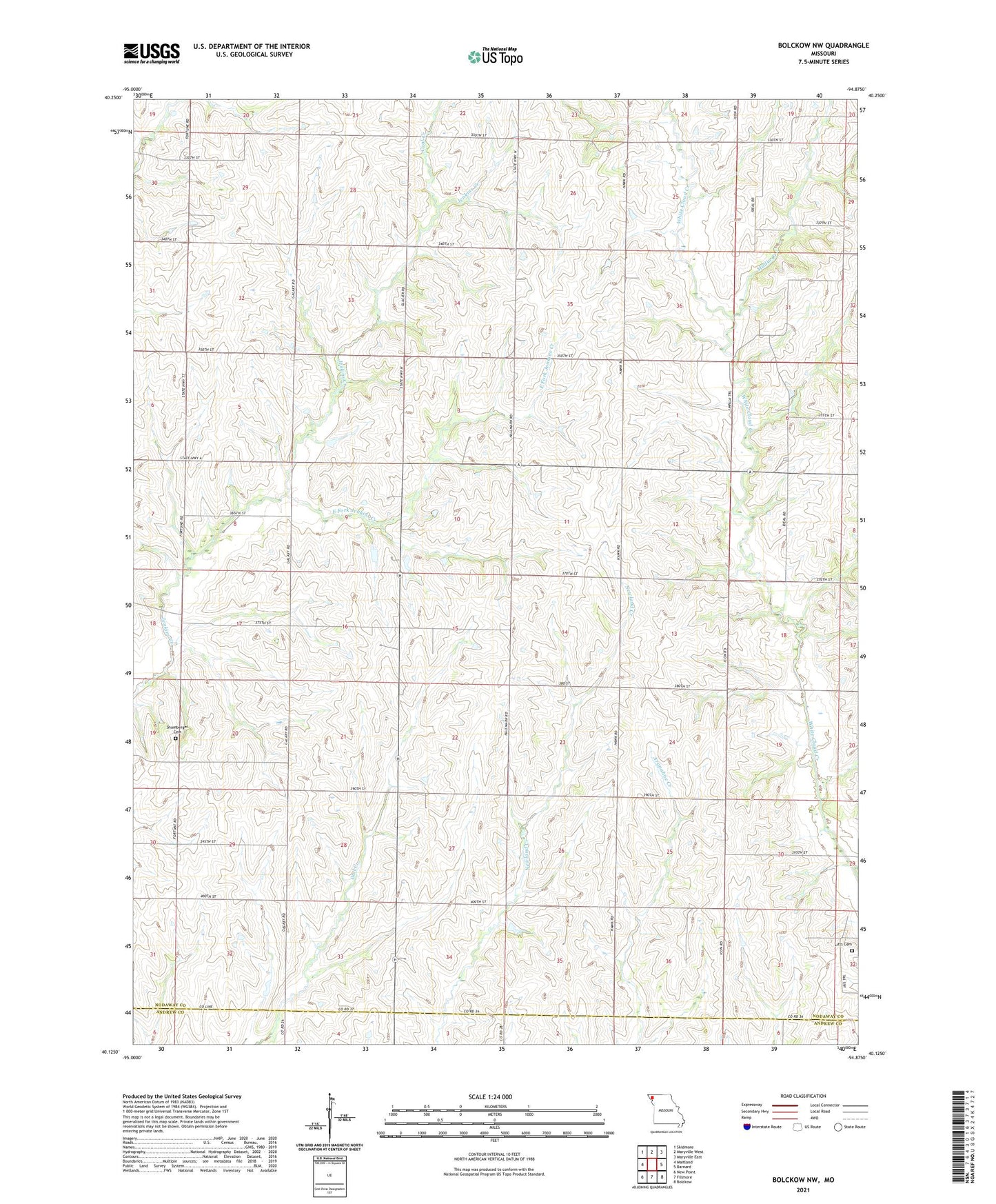
Bolckow NW Missouri US Topo Map
Couldn't load pickup availability
2021 topographic map quadrangle Bolckow NW in the state of Missouri. Scale: 1:24000. Based on the newly updated USGS 7.5' US Topo map series, this map is in the following counties: Nodaway, Andrew. The map contains contour data, water features, and other items you are used to seeing on USGS maps, but also has updated roads and other features. This is the next generation of topographic maps. Printed on high-quality waterproof paper with UV fade-resistant inks.
Quads adjacent to this one:
West: Maitland
Northwest: Skidmore
North: Maryville West
Northeast: Maryville East
East: Barnard
Southeast: Bolckow
South: Fillmore
Southwest: New Point
This map covers the same area as the classic USGS quad with code o40094b8.
Contains the following named places: Baker School, Barnes School, Bethany Church, Blackman School, Centenary Church, Coal Creek, Common Sense School, East Fork Jenkins Creek, Hazel Dell School, Litts Cemetery, Lyle School, Maple Grove School, Miller School, Morgan School, Mullin Creek, Pleasant Grove Church, Shamberger Cemetery, Show Me the Sky Airport, Singrey School, Swan Chapel, Township of Hughes, Township of White Cloud, Trego School, White Cloud Post Office, Whitecloud