MyTopo
Fillmore Missouri US Topo Map
Couldn't load pickup availability
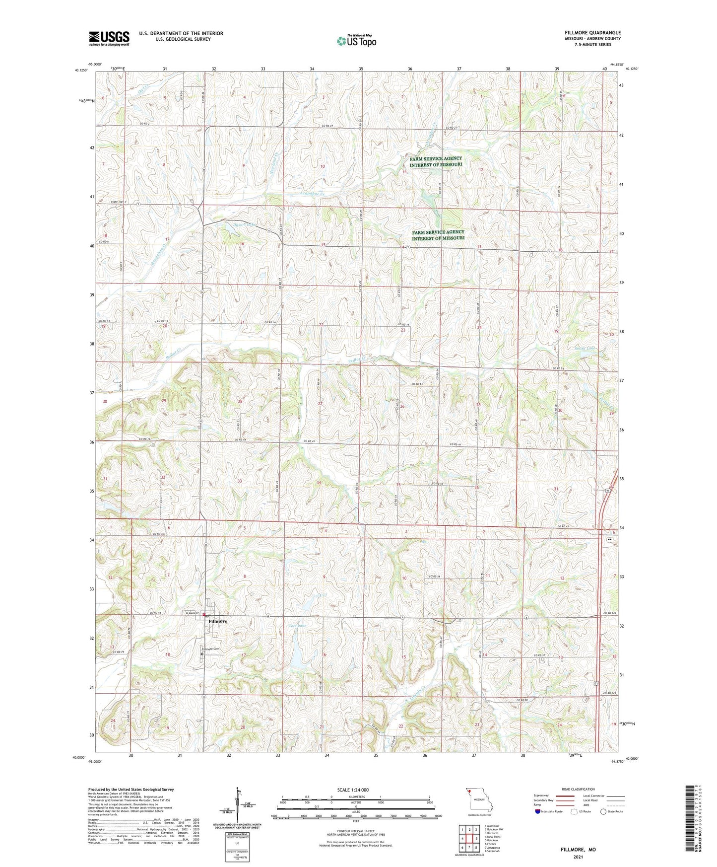
2021 topographic map quadrangle Fillmore in the state of Missouri. Scale: 1:24000. Based on the newly updated USGS 7.5' US Topo map series, this map is in the following counties: Andrew. The map contains contour data, water features, and other items you are used to seeing on USGS maps, but also has updated roads and other features. This is the next generation of topographic maps. Printed on high-quality waterproof paper with UV fade-resistant inks.
Quads adjacent to this one:
West: New Point
Northwest: Maitland
North: Bolckow NW
Northeast: Barnard
East: Bolckow
Southeast: Savannah
South: Amazonia
Southwest: Forbes
This map covers the same area as the classic USGS quad with code o40094a8.
Contains the following named places: Antioch Church, Arapahoe School, Carr School, City of Fillmore, Cole Lake, Cole Lake Dam, Cole Landing Strip, Dysart Lake, Dysart Lake Dam, Fillmore, Fillmore Cemetery, Fillmore Fire Protection District, Fillmore Post Office, Fleming School, Furst Landing Strip, Gravel Wall School, Housman School, Lazy W Farms Airport, Newland Creek, Nida, North Andrew Elementary School, North Andrew High School, North Andrew Middle School, North Star School, Parker, Parker Post Office, Prairie Temple Church, Rankin, Smith Lake, Smith Lake Dam, Stone Church School, Township of Clay, Township of Jackson, Union School, Wade School, West Star School, ZIP Code: 64449