MyTopo
Matkins Missouri US Topo Map
Couldn't load pickup availability
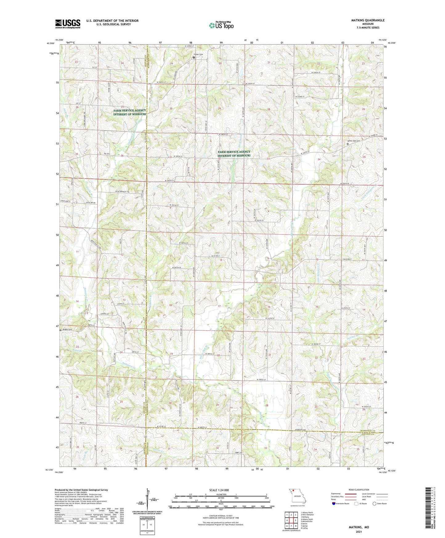
2021 topographic map quadrangle Matkins in the state of Missouri. Scale: 1:24000. Based on the newly updated USGS 7.5' US Topo map series, this map is in the following counties: Harrison, Gentry, Daviess. The map contains contour data, water features, and other items you are used to seeing on USGS maps, but also has updated roads and other features. This is the next generation of topographic maps. Printed on high-quality waterproof paper with UV fade-resistant inks.
Quads adjacent to this one:
West: Albany South
Northwest: Albany North
North: New Hampton
Northeast: Bethany
East: Mitchellville
Southeast: Coffey
South: McFall
Southwest: Berlin
Contains the following named places: Bodam School, Crab Orchard School, Dover School, Foster Cemetery, Heath Church, Jacks Branch, Latchel Branch, Maple Grove School, Matkins, Matkins Church, New Hope Church, Newcastle Church, Pilot Knob School, Pleasant Ridge School, Shady Dell School, Township of Butler, Tull School, Union Chapel, Victor School, Ward Branch, White Oak Cemetery, White Oak Creek, White Oak Union Church, Wolf Den Branch, Wright Cemetery, ZIP Code: 64657