MyTopo
Coffey Missouri US Topo Map
Couldn't load pickup availability
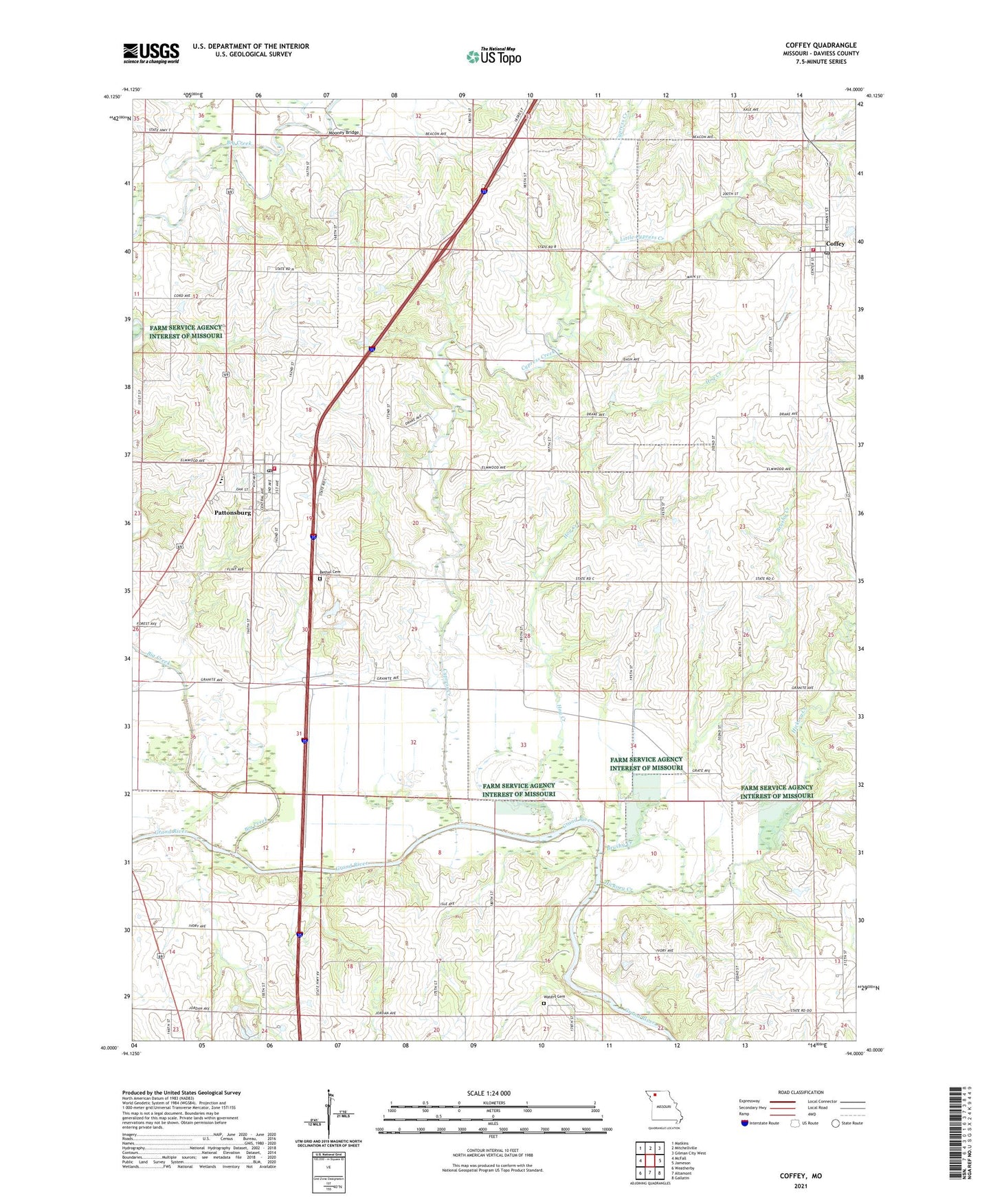
2021 topographic map quadrangle Coffey in the state of Missouri. Scale: 1:24000. Based on the newly updated USGS 7.5' US Topo map series, this map is in the following counties: Daviess. The map contains contour data, water features, and other items you are used to seeing on USGS maps, but also has updated roads and other features. This is the next generation of topographic maps. Printed on high-quality waterproof paper with UV fade-resistant inks.
Quads adjacent to this one:
West: McFall
Northwest: Matkins
North: Mitchellville
Northeast: Gilman City West
East: Jameson
Southeast: Gallatin
South: Altamont
Southwest: Weatherby
This map covers the same area as the classic USGS quad with code o40094a1.
Contains the following named places: Bethel Church, Big Creek, Broderick School, Brushy Creek, City of Coffey, City of Pattonsburg, Coffey, Coffey Fire Protection District, Coffey Post Office, Cypress, Cypress Creek, Everly School, Fairview School, Feurt School, Freeport School, Hickory Creek, Hog Creek, Little Cypress Creek, Mooney Bridge, North Daviess Elementary School, Pattonsburg, Pattonsburg Fire Department, Pattonsburg High School, Pattonsburg Post Office, Salem Coffey P O and Station, Shady Grove School, Township of Salem, Virginia Ridge School, Waters Cemetery