MyTopo
McFall Missouri US Topo Map
Couldn't load pickup availability
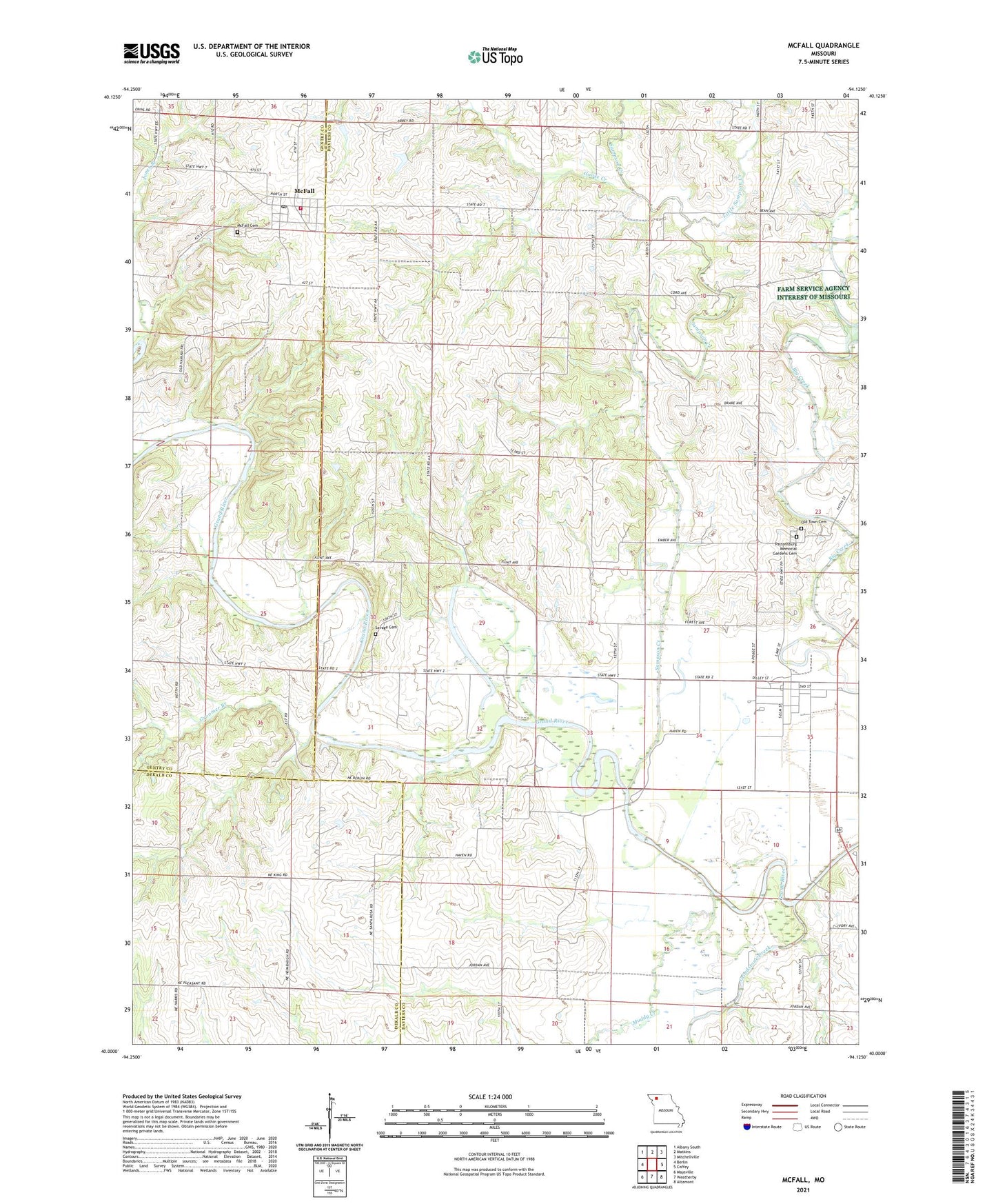
2021 topographic map quadrangle McFall in the state of Missouri. Scale: 1:24000. Based on the newly updated USGS 7.5' US Topo map series, this map is in the following counties: Daviess, Gentry, DeKalb. The map contains contour data, water features, and other items you are used to seeing on USGS maps, but also has updated roads and other features. This is the next generation of topographic maps. Printed on high-quality waterproof paper with UV fade-resistant inks.
Quads adjacent to this one:
West: Berlin
Northwest: Albany South
North: Matkins
Northeast: Mitchellville
East: Coffey
Southeast: Altamont
South: Weatherby
Southwest: Maysville
Contains the following named places: Best Church, City of McFall, Conestoga School, Dilly School, Elam School, Goose Creek, Grindstone Creek, Groomer Branch, Heath School, Jones Branch, Koger School, Little Sampson Creek, McFall, McFall Cemetery, McFall Fire Department, Mcfall Post Office, Muddy Creek, Oak Ridge School, Old Pattonsburg, Pattonsburg Elementary School, Round Top School, Sampson Creek, Savage Cemetery, Township of Benton, Walnut Grove School, Watson Airport, Woodward Lake Dam, ZIP Code: 64670