MyTopo
Mexico West Missouri US Topo Map
Couldn't load pickup availability
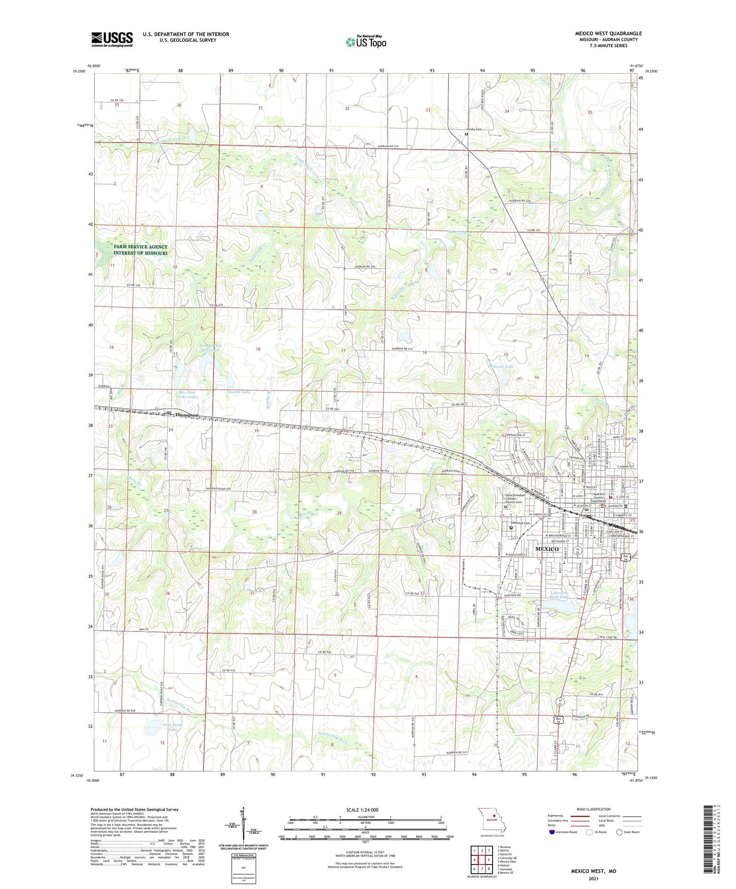
2021 topographic map quadrangle Mexico West in the state of Missouri. Scale: 1:24000. Based on the newly updated USGS 7.5' US Topo map series, this map is in the following counties: Audrain. The map contains contour data, water features, and other items you are used to seeing on USGS maps, but also has updated roads and other features. This is the next generation of topographic maps. Printed on high-quality waterproof paper with UV fade-resistant inks.
Quads adjacent to this one:
West: Centralia NE
Northwest: Rowena
North: Molino
Northeast: Santa Fe
East: Mexico East
Southeast: Mexico SE
South: Auxvasse
Southwest: Hatton
Contains the following named places: Big Branch, Brushy Branch, Carter Lake Dam, Carter School, Davis Creek, Davis H. Hart Career Center, Deimeke Lake, Deimeke Lake Dam, Duly School, Elmwood Cemetery, Eugene Field Elementary School, Fish Branch, Garfield School, Hawthorne Elementary School, Hurdle School, Jesse School, Kallenbach and Becker Lake Dam, KJAB-FM (Mexico), KWWR-FM (Mexico), Lakeview Park, Lakeview Park Lake, Little Skull Lick Creek, Locke Lake, Locke Lake East Dam, Locke Lake North Dam, Locke Lake West Dam, Maple Grove School, Mexico, Mexico High School, Mexico Middle School, Mexico Police Department, Mexico Post Office, Missouri Power and Light Dam, Mrs Sam Locke Lake, Number 102 Dam, Number 221 Reservoir, Paul Veale Lake, Plunkett Park, Saint Brendan School, Saint Brendans Catholic Church Cemetery, Simms School, Skull Lick Creek, South Trails Shopping Center, SSM Health Saint Mary's Hospital - Audrain, Sunrise Church, Thompson, Thompson Post Office, Township of Salt River, Trinity Cemetery, West Plaza, Williams Dam East, ZIP Code: 65265