MyTopo
Miami Missouri US Topo Map
Couldn't load pickup availability
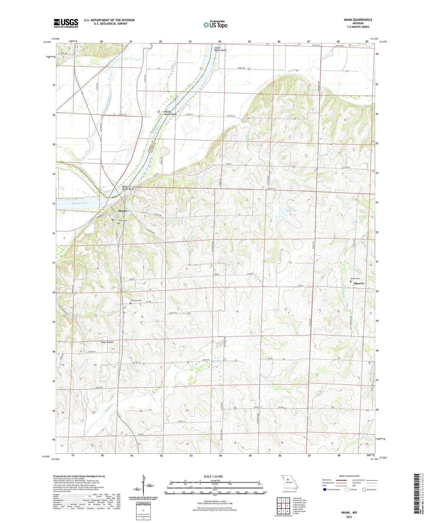
2021 topographic map quadrangle Miami in the state of Missouri. Scale: 1:24000. Based on the newly updated USGS 7.5' US Topo map series, this map is in the following counties: Saline, Carroll. The map contains contour data, water features, and other items you are used to seeing on USGS maps, but also has updated roads and other features. This is the next generation of topographic maps. Printed on high-quality waterproof paper with UV fade-resistant inks.
Quads adjacent to this one:
West: Miami Station
Northwest: Bosworth
North: Brunswick West
Northeast: Brunswick East
East: New Frankfort
Southeast: Slater
South: Marshall North
Southwest: Malta Bend
Contains the following named places: Bates School, Bell Branch, Bethel Church, Bluff School, Burruss School, Christian Cemetery, City of Miami, Elson Lake Dam, Elson Reservoir, Harmony Church, Lower Miami Bend, Miami, Miami Cemetery, Miami Elementary School, Miami Post Office, Middle Miami Bend, Pleasant Grove School, Reynolds School, Ross School, Sharon, Sharon School, Shilo Church, Township of Miami, Upper Miami Bend, Wakenda Creek, Wheeler School, ZIP Code: 65344