MyTopo
Marshall North Missouri US Topo Map
Couldn't load pickup availability
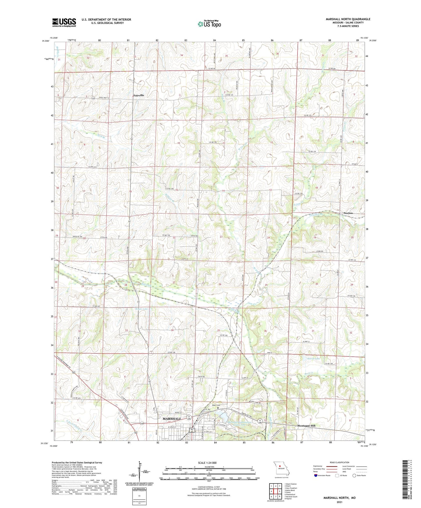
2021 topographic map quadrangle Marshall North in the state of Missouri. Scale: 1:24000. Based on the newly updated USGS 7.5' US Topo map series, this map is in the following counties: Saline. The map contains contour data, water features, and other items you are used to seeing on USGS maps, but also has updated roads and other features. This is the next generation of topographic maps. Printed on high-quality waterproof paper with UV fade-resistant inks.
Quads adjacent to this one:
West: Malta Bend
Northwest: Miami Station
North: Miami
Northeast: New Frankfort
East: Slater
Southeast: Napton
South: Marshall South
Southwest: Shackleford
This map covers the same area as the classic USGS quad with code o39093b2.
Contains the following named places: Bryan Lake, Bryan Lake Dam, Chappell School, Cow Creek, East Cow Creek, Fairville, Herring School, Jester School, KMMO-AM (Marshall), KMMO-FM (Marshall), Maple Grove School, Marsh Lake, Marsh Lake Dam, Marshall Habilitation Center, Marshall Habilitation Center Lake, Marshall State School Lake Dam, Montague Hill, Mount Carmel Church, Norton, Odell Cemetery, Plum Branch, Prairie Home School, Robert Leigh School, Rock Creek, Saline County, Sandy Hill School, State School Dam B, Sulphur Springs School, Sunny Side School, Thrailkill Branch, Wallys Lake, Wallys Lake Dam, West Cow Creek, Wildcat Branch