MyTopo
Slater Missouri US Topo Map
Couldn't load pickup availability
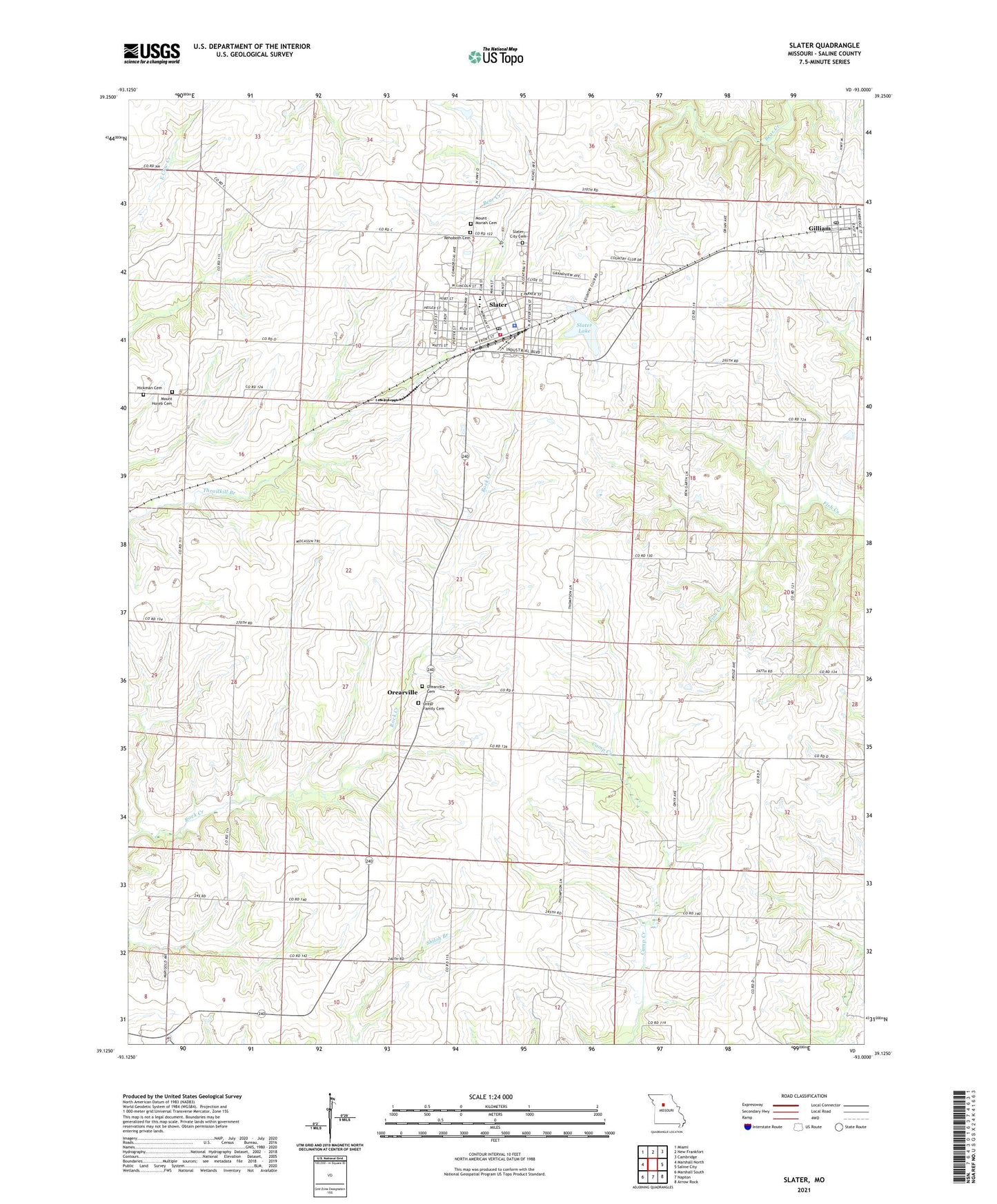
2021 topographic map quadrangle Slater in the state of Missouri. Scale: 1:24000. Based on the newly updated USGS 7.5' US Topo map series, this map is in the following counties: Saline. The map contains contour data, water features, and other items you are used to seeing on USGS maps, but also has updated roads and other features. This is the next generation of topographic maps. Printed on high-quality waterproof paper with UV fade-resistant inks.
Quads adjacent to this one:
West: Marshall North
Northwest: Miami
North: New Frankfort
Northeast: Cambridge
East: Saline City
Southeast: Arrow Rock
South: Napton
Southwest: Marshall South
This map covers the same area as the classic USGS quad with code o39093b1.
Contains the following named places: Brick School, City of Gilliam, City of Slater, Clay Center School, George School, Gilliam, Gilliam Elementary School, Gilliam Post Office, Hickman Cemetery, Linn Grove School, Mount Horeb Cemetery, Mount Horeb School, Mount Moriah Cemetery, Only Way Lake Dam, Orearville, Orearville Elementary School, Potter School, Slater, Slater Alexander Elementary School, Slater City Cemetery, Slater City Fire Department, Slater High School, Slater Lake, Slater Memorial Airport, Slater Police Department, Slater Post Office, Township of Clay, ZIP Code: 65349