MyTopo
Malta Bend Missouri US Topo Map
Couldn't load pickup availability
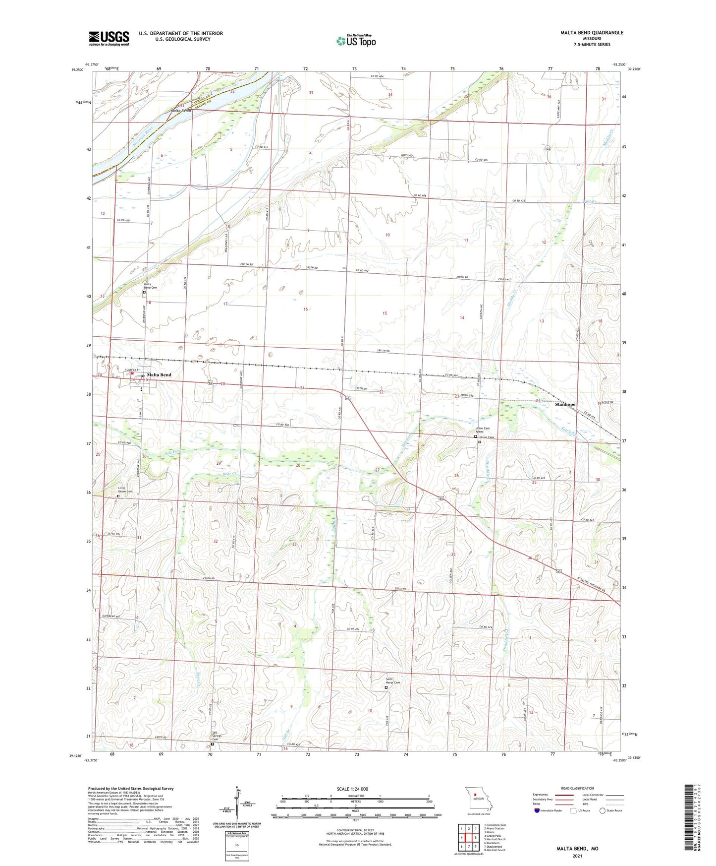
2021 topographic map quadrangle Malta Bend in the state of Missouri. Scale: 1:24000. Based on the newly updated USGS 7.5' US Topo map series, this map is in the following counties: Saline, Carroll. The map contains contour data, water features, and other items you are used to seeing on USGS maps, but also has updated roads and other features. This is the next generation of topographic maps. Printed on high-quality waterproof paper with UV fade-resistant inks.
Quads adjacent to this one:
West: Grand Pass
Northwest: Carrollton East
North: Miami Station
Northeast: Miami
East: Marshall North
Southeast: Marshall South
South: Shackleford
Southwest: Blackburn
This map covers the same area as the classic USGS quad with code o39093b3.
Contains the following named places: Bear Creek, Blosser, Central School, Lincoln School, Little Grove Cemetery, Malta Bend, Malta Bend Cemetery, Malta Bend Elementary School, Malta Bend Fire Station, Malta Bend High School, Malta Bend Post Office, Malta Bends, Muddy Creek, Robertson Lake, Robertson Lake Dam, Saint Marys Cemetery, Saline Church, Salt Branch, Salt Springs Cemetery, Salt Springs School, Stanhope, Steele School, Straddle Creek, Town of Malta Bend, Union Church, Union School, Wolf Branch, ZIP Code: 65339