MyTopo
Middletown Missouri US Topo Map
Couldn't load pickup availability
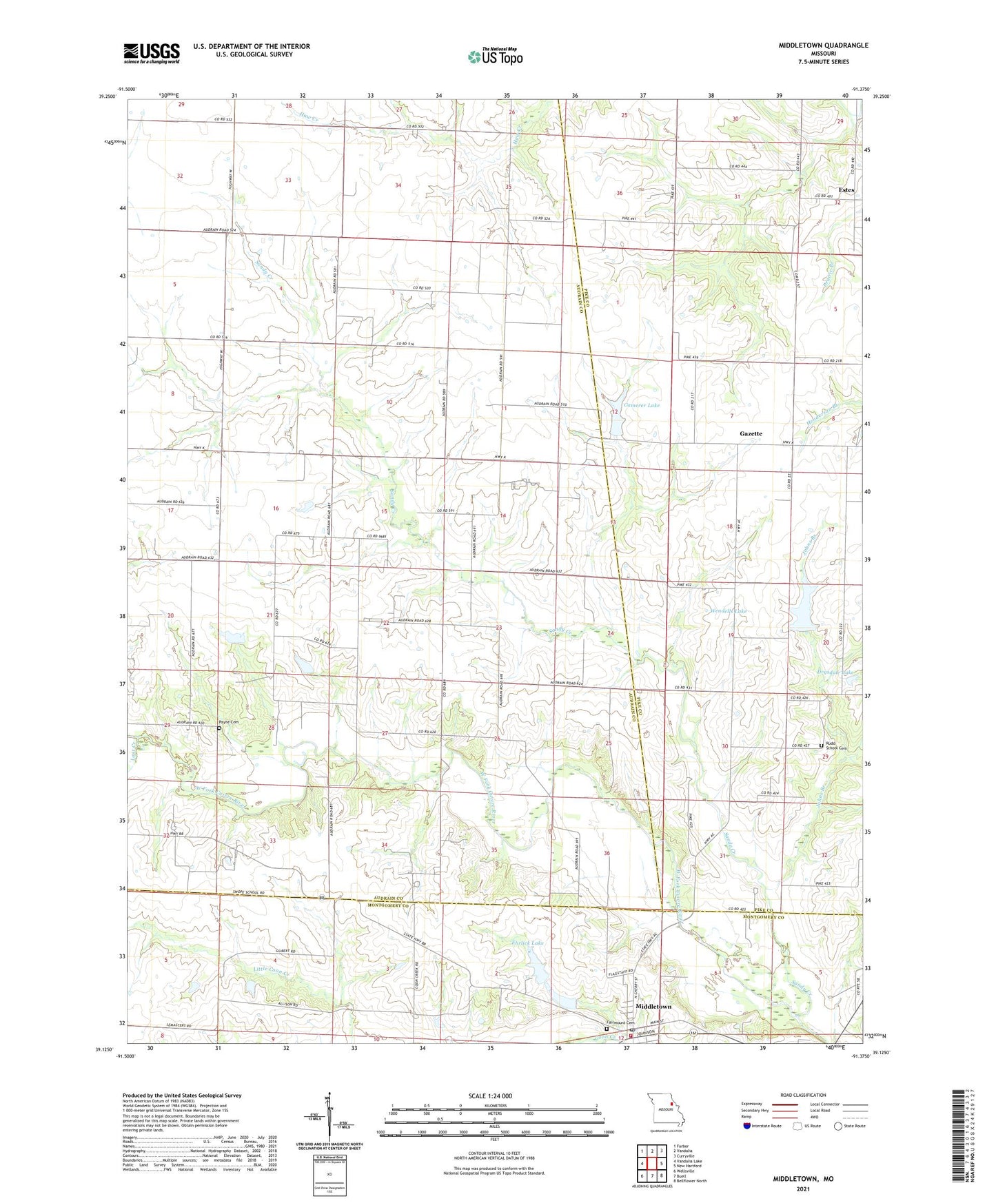
2021 topographic map quadrangle Middletown in the state of Missouri. Scale: 1:24000. Based on the newly updated USGS 7.5' US Topo map series, this map is in the following counties: Audrain, Pike, Montgomery. The map contains contour data, water features, and other items you are used to seeing on USGS maps, but also has updated roads and other features. This is the next generation of topographic maps. Printed on high-quality waterproof paper with UV fade-resistant inks.
Quads adjacent to this one:
West: Vandalia Lake
Northwest: Farber
North: Vandalia
Northeast: Curryville
East: New Hartford
Southeast: Bellflower North
South: Buell
Southwest: Wellsville
Contains the following named places: Allison Lake Dam, Barber Lake Dam, Bruce Crysdale Dam, Camerer Dam, Camerer Lake, Central Union Church, Clithero Lake, Clithero Lake Dam, Crow School, Culwell School, Drysdale Lake, Ehrlick Dam South, Ehrlick Lake, Ehrlick Lake Dam, Estes, Estes School, Fairmount Cemetery, Gazette, Hall School, Heim Lake Dam, Johns Branch, Lost Creek, Middletown, Middletown Fire Protection District, Middletown Post Office, Mount Carmel, Mount Carmel Post Office, Payne Cemetery, Ray Lake Dam, Rudd School, Rudd School Cemetery, Sandy Creek, Town of Middletown, Trower School, Wendell L Heim Lake, Wendells Lake, Wendells Lake Dam, Whiteside School