MyTopo
Buell Missouri US Topo Map
Couldn't load pickup availability
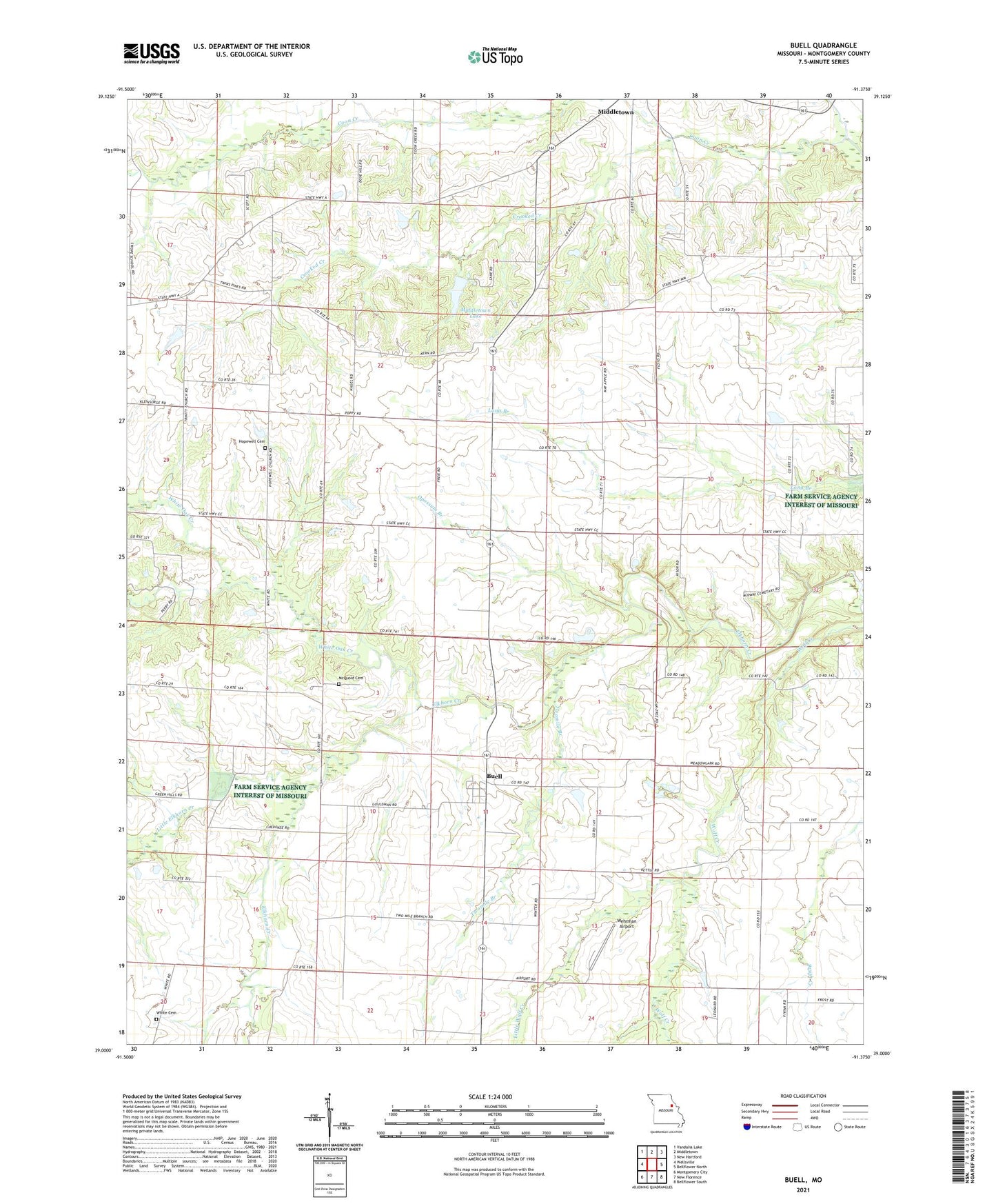
2021 topographic map quadrangle Buell in the state of Missouri. Scale: 1:24000. Based on the newly updated USGS 7.5' US Topo map series, this map is in the following counties: Montgomery. The map contains contour data, water features, and other items you are used to seeing on USGS maps, but also has updated roads and other features. This is the next generation of topographic maps. Printed on high-quality waterproof paper with UV fade-resistant inks.
Quads adjacent to this one:
West: Wellsville
Northwest: Vandalia Lake
North: Middletown
Northeast: New Hartford
East: Bellflower North
Southeast: Bellflower South
South: New Florence
Southwest: Montgomery City
This map covers the same area as the classic USGS quad with code o39091a4.
Contains the following named places: Buell, Buell Census Designated Place, Cahall Lake Dam, Coon Creek, Crooked Creek, Cross Roads School, Elkhorn Church, Garrison Lake Dam, Hagemier Lake Dam, Hazel Dell School, Hopewell Cemetery, Hopewell Church, Hopewell School, Kleinsorge Lake Dam, Little Coon Creek, Little Elkhorn Creek, Little Wolf Creek, Locust Grove School, Maupin Lake Dam, McQuoid Cemetery, Meadow Lark School, Middletown Elementary School, Middletown Lake, Number 763 Dam, Opossum Branch, Postoak School, Prohibition, Prohibition Post Office, River Acres Lake Dam, Rodgers School, Slavins Lake Dam, Stanek Lake Dam, Thomas School, Trinity Church, Twomile Branch, Walton Lake Dam, Wehrman Airport, White Cemetery, White Lake Dam, White Oak Creek, Young School