MyTopo
Wellsville Missouri US Topo Map
Couldn't load pickup availability
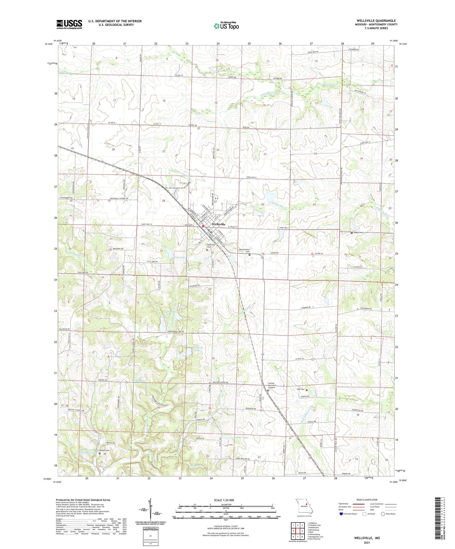
2021 topographic map quadrangle Wellsville in the state of Missouri. Scale: 1:24000. Based on the newly updated USGS 7.5' US Topo map series, this map is in the following counties: Montgomery. The map contains contour data, water features, and other items you are used to seeing on USGS maps, but also has updated roads and other features. This is the next generation of topographic maps. Printed on high-quality waterproof paper with UV fade-resistant inks.
Quads adjacent to this one:
West: Martinsburg
Northwest: Laddonia
North: Vandalia Lake
Northeast: Middletown
East: Buell
Southeast: New Florence
South: Montgomery City
Southwest: Williamsburg
This map covers the same area as the classic USGS quad with code o39091a5.
Contains the following named places: Appling School, Bethel Cemetery, Bethel Church, City Lake, City of Wellsville, Coal Branch, Eckler School, Fairview School, Harris School, Hayes Lake Dam, Ki-Wi Lake, Ki-Wi Lake Dam, Letterman Lake Dam, Little Coon Creek, Mononame 764 Dam, Morgan School, Nestor and Literman Lake, Nutter Lake East Dam, Nutter Lake West Dam, Oliver Branch, Peery Cemetery, Resurrection Cemetery, Scratchers Branch, Seal Cemetery, Shelton Lake Dam, Sportsman Lake, Starr Lake Dam, Sunrise Memorial Gardens, Township of Montgomery, Township of Upper Loutre, Wellsville, Wellsville Cemetery, Wellsville City Lake Dam, Wellsville Lake, Wellsville Lake Dam, Wellsville Lake State Wildlife Management Ar, Wellsville Police Department, Wellsville Post Office, Wellsville Rural Fire Department, Wellsville-Middletown Elementary School, Wellsville-Middletown Junior-Senior High School, White Hall School, White Oak School, Zander Lake, Zander Lake Dam, ZIP Code: 63384