MyTopo
Milan East Missouri US Topo Map
Couldn't load pickup availability
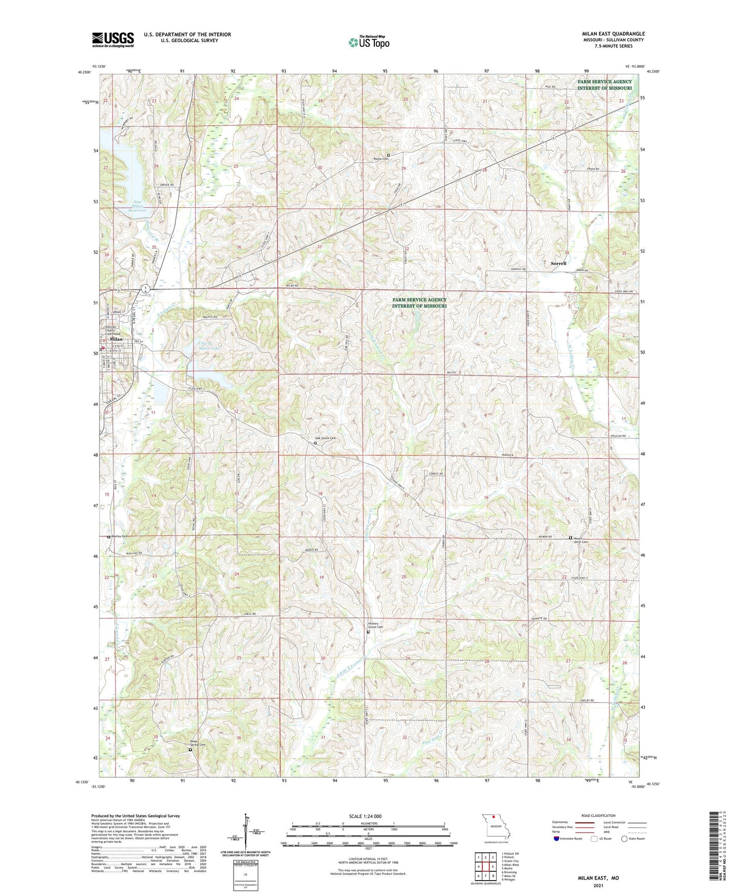
2021 topographic map quadrangle Milan East in the state of Missouri. Scale: 1:24000. Based on the newly updated USGS 7.5' US Topo map series, this map is in the following counties: Sullivan. The map contains contour data, water features, and other items you are used to seeing on USGS maps, but also has updated roads and other features. This is the next generation of topographic maps. Printed on high-quality waterproof paper with UV fade-resistant inks.
Quads adjacent to this one:
West: Milan West
Northwest: Pollock SW
North: Pollock
Northeast: Green City
East: Mystic
Southeast: Winigan
South: Milan SE
Southwest: Browning
Contains the following named places: City of Milan, City of Milan Lake, Deep Spring Cemetery, Elmwood Branch, Elmwood City Lake Dam, Frazier School, Hickory Grove Cemetery, Hickory Grove School, Holly Hill School, Ivy Hill School, Lee School, Marlay Cemetery, Milan Lake Dam - South Dam, Milan Lake Dam-North Dam, Milan Police Department, Milan Post Office, Milan Rural Fire Department, Mount Moriah Church, Mount Olive Cemetery, New Milan Reservoir, Number 41 Lake, Oak Grove Cemetery, Oak Grove School, Payne Cemetery, Payne School, Pleasant Grove School, Prairie Flower School, Sorrell, Sorrell Post Office, Sullivan County, Sullivan County Sheriff's Office, Sunny Ridge School, Township of Polk