MyTopo
Pollock SW Missouri US Topo Map
Couldn't load pickup availability
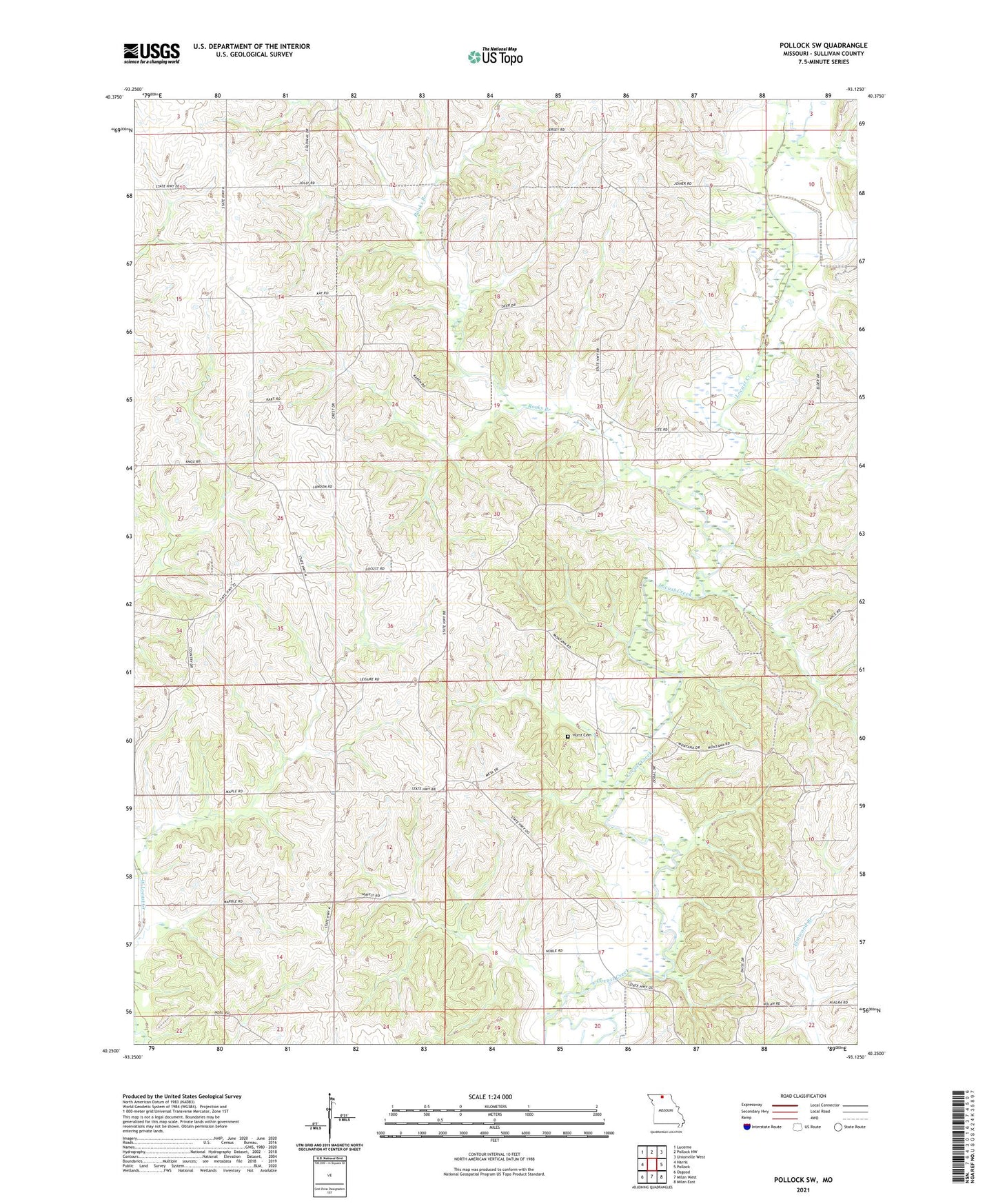
2021 topographic map quadrangle Pollock SW in the state of Missouri. Scale: 1:24000. Based on the newly updated USGS 7.5' US Topo map series, this map is in the following counties: Sullivan. The map contains contour data, water features, and other items you are used to seeing on USGS maps, but also has updated roads and other features. This is the next generation of topographic maps. Printed on high-quality waterproof paper with UV fade-resistant inks.
Quads adjacent to this one:
West: Harris
Northwest: Lucerne
North: Pollock NW
Northeast: Unionville West
East: Pollock
Southeast: Milan East
South: Milan West
Southwest: Osgood
This map covers the same area as the classic USGS quad with code o40093c2.
Contains the following named places: Bairdston, Bairdstown Church, Bairdstown School, Center Point School, Hurst Cemetery, Judson, Judson Church, Judson School, K and W Farms Lake Dam, Liberty Union Church, Rooks Branch, Ross School, Thomas Union Church, Turner School, Wolfe School