MyTopo
Milan SE Missouri US Topo Map
Couldn't load pickup availability
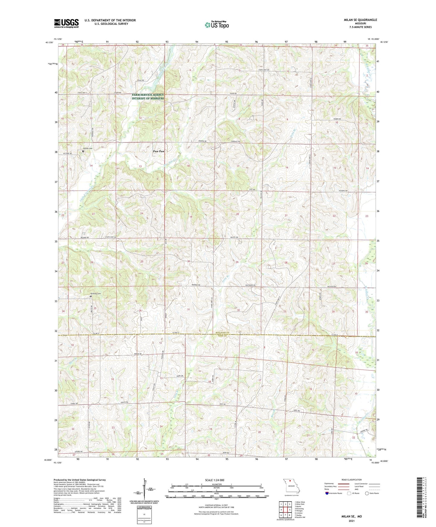
2021 topographic map quadrangle Milan SE in the state of Missouri. Scale: 1:24000. Based on the newly updated USGS 7.5' US Topo map series, this map is in the following counties: Sullivan, Linn. The map contains contour data, water features, and other items you are used to seeing on USGS maps, but also has updated roads and other features. This is the next generation of topographic maps. Printed on high-quality waterproof paper with UV fade-resistant inks.
Quads adjacent to this one:
West: Browning
Northwest: Milan West
North: Milan East
Northeast: Mystic
East: Winigan
Southeast: Bucklin NW
South: Shelby
Southwest: Linneus
Contains the following named places: Bundridge School, Crossroads School, Dickinson School, Enterprise, Enterprise School, Fairview School, Hollon Cemetery, Johnson School, Knifong Cemetery, Knifong School, Maher Lake Dam, Meservey Lake Dam, Mount Zion Church, Number 44 Lake, Opel, Opel Post Office, Paw Paw, Paw Paw Creek, Prairie Mound School, Taylor Lake Section 19 Dam, Taylor Lake Section 24 Dam, Township of Enterprise, Township of Pleasant Hill, Walnut Grove School